
K31A O'Neill, NE, USA - Earthquake Result Viewer
| ||||||||||||||||||
| ||||||||||||||||||
| ||||||||||||||||||
|
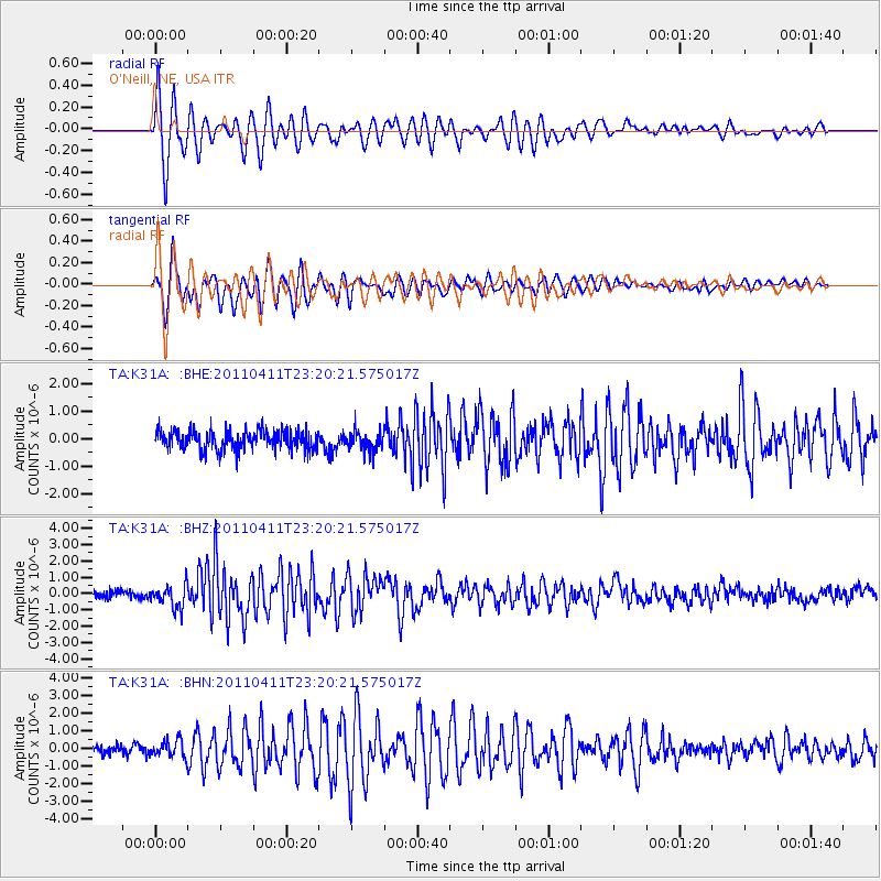
Signal To Noise
| Channel | StoN | STA | LTA |
| TA:K31A: :BHZ:20110411T23:20:21.575017Z | 3.14785 | 6.9570746E-7 | 2.2101037E-7 |
| TA:K31A: :BHN:20110411T23:20:21.575017Z | 2.0483708 | 4.7973276E-7 | 2.342021E-7 |
| TA:K31A: :BHE:20110411T23:20:21.575017Z | 0.99587333 | 3.5201705E-7 | 3.5347574E-7 |
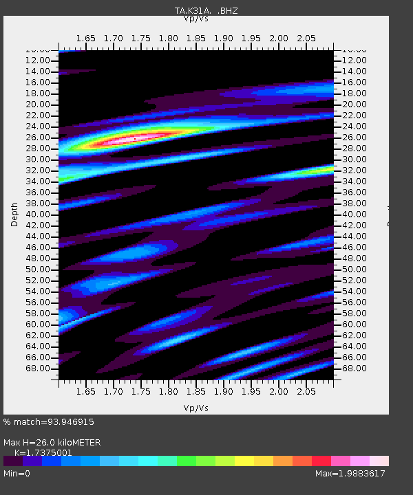
| Arrivals | |
| Ps | 3.0 SECOND |
| PpPs | 11 SECOND |
| PsPs/PpSs | 14 SECOND |

