
G32A Webster, SD, USA - Earthquake Result Viewer
| ||||||||||||||||||
| ||||||||||||||||||
| ||||||||||||||||||
|
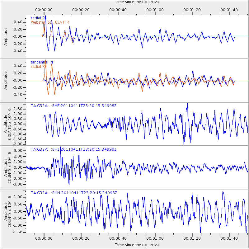
Signal To Noise
| Channel | StoN | STA | LTA |
| TA:G32A: :BHZ:20110411T23:20:15.34998Z | 4.316366 | 6.585728E-7 | 1.5257575E-7 |
| TA:G32A: :BHN:20110411T23:20:15.34998Z | 1.0877801 | 3.7559343E-7 | 3.4528432E-7 |
| TA:G32A: :BHE:20110411T23:20:15.34998Z | 0.30856407 | 1.8755976E-7 | 6.078471E-7 |
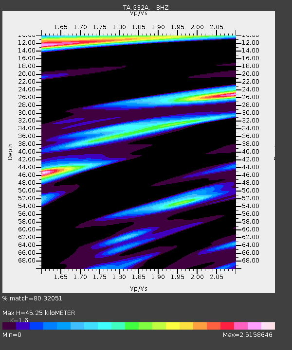
| Arrivals | |
| Ps | 4.3 SECOND |
| PpPs | 17 SECOND |
| PsPs/PpSs | 22 SECOND |

