
F31A Hecla, SD, USA - Earthquake Result Viewer
| ||||||||||||||||||
| ||||||||||||||||||
| ||||||||||||||||||
|
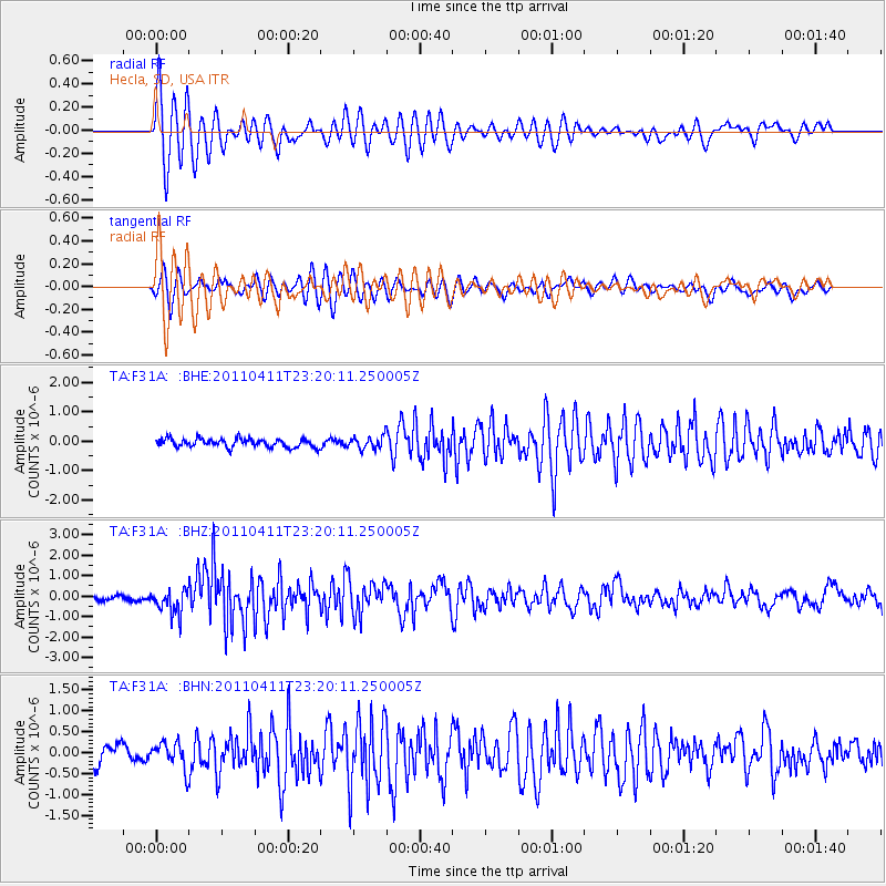
Signal To Noise
| Channel | StoN | STA | LTA |
| TA:F31A: :BHZ:20110411T23:20:11.250005Z | 4.4065046 | 6.012724E-7 | 1.364511E-7 |
| TA:F31A: :BHN:20110411T23:20:11.250005Z | 1.1252626 | 3.110408E-7 | 2.764162E-7 |
| TA:F31A: :BHE:20110411T23:20:11.250005Z | 1.4950731 | 2.1315454E-7 | 1.4257132E-7 |
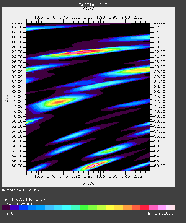
| Arrivals | |
| Ps | 9.2 SECOND |
| PpPs | 29 SECOND |
| PsPs/PpSs | 38 SECOND |

