You are here: Home > Network List > TA - USArray Transportable Network (new EarthScope stations) Stations List
> Station F32A Veblen, SD, USA > Earthquake Result Viewer
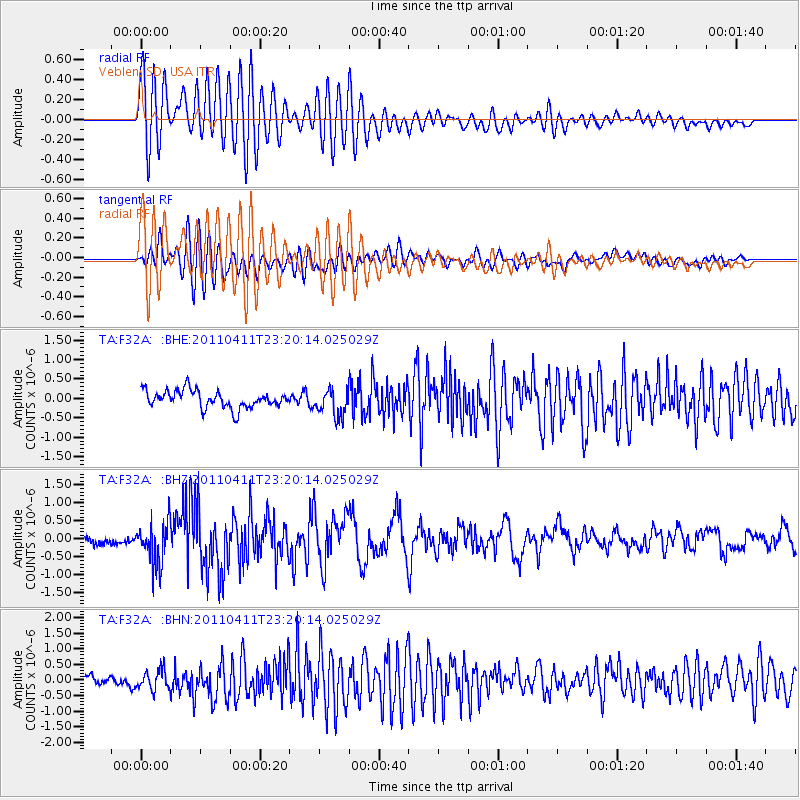
F32A Veblen, SD, USA - Earthquake Result Viewer
*The percent match for this event was below the threshold and hence no stack was calculated.
| Earthquake location: |
Near East Coast Of Honshu, Japan |
| Earthquake latitude/longitude: |
35.4/140.6 |
| Earthquake time(UTC): |
2011/04/11 (101) 23:08:16 GMT |
| Earthquake Depth: |
15 km |
| Earthquake Magnitude: |
6.0 MB, 6.1 MS, 6.2 MW, 6.2 MW |
| Earthquake Catalog/Contributor: |
WHDF/NEIC |
|
| Network: |
TA USArray Transportable Network (new EarthScope stations) |
| Station: |
F32A Veblen, SD, USA |
| Lat/Lon: |
45.87 N/97.13 W |
| Elevation: |
371 m |
|
| Distance: |
83.8 deg |
| Az: |
36.445 deg |
| Baz: |
316.016 deg |
| Ray Param: |
$rayparam |
*The percent match for this event was below the threshold and hence was not used in the summary stack. |
|
| Radial Match: |
78.25929 % |
| Radial Bump: |
400 |
| Transverse Match: |
59.394993 % |
| Transverse Bump: |
400 |
| SOD ConfigId: |
356183 |
| Insert Time: |
2011-09-27 11:18:12.167 +0000 |
| GWidth: |
2.5 |
| Max Bumps: |
400 |
| Tol: |
0.001 |
|
Signal To Noise
| Channel | StoN | STA | LTA |
| TA:F32A: :BHZ:20110411T23:20:14.025029Z | 4.92032 | 5.773361E-7 | 1.173371E-7 |
| TA:F32A: :BHN:20110411T23:20:14.025029Z | 1.8687692 | 3.0980647E-7 | 1.6578102E-7 |
| TA:F32A: :BHE:20110411T23:20:14.025029Z | 1.5084932 | 3.4073364E-7 | 2.2587682E-7 |
| Arrivals |
| Ps | |
| PpPs | |
| PsPs/PpSs | |


