You are here: Home > Network List > AZ - ANZA Regional Network Stations List
> Station SMER AZ.SMER > Earthquake Result Viewer
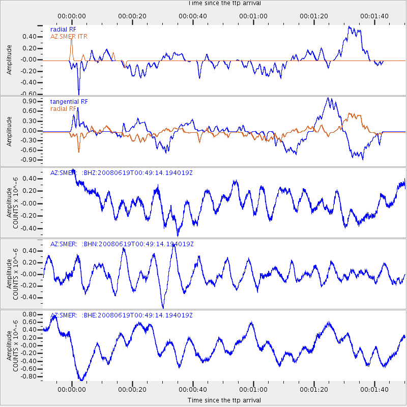
SMER AZ.SMER - Earthquake Result Viewer
*The percent match for this event was below the threshold and hence no stack was calculated.
| Earthquake location: |
New Britain Region, P.N.G. |
| Earthquake latitude/longitude: |
-4.9/151.8 |
| Earthquake time(UTC): |
2008/06/19 (171) 00:36:45 GMT |
| Earthquake Depth: |
143 km |
| Earthquake Magnitude: |
5.5 MW, 5.2 MB, 5.4 MW |
| Earthquake Catalog/Contributor: |
WHDF/NEIC |
|
| Network: |
AZ ANZA Regional Network |
| Station: |
SMER AZ.SMER |
| Lat/Lon: |
33.46 N/117.17 W |
| Elevation: |
355 m |
|
| Distance: |
93.6 deg |
| Az: |
56.875 deg |
| Baz: |
266.488 deg |
| Ray Param: |
$rayparam |
*The percent match for this event was below the threshold and hence was not used in the summary stack. |
|
| Radial Match: |
54.441715 % |
| Radial Bump: |
400 |
| Transverse Match: |
57.30536 % |
| Transverse Bump: |
400 |
| SOD ConfigId: |
2504 |
| Insert Time: |
2010-02-26 20:47:03.454 +0000 |
| GWidth: |
2.5 |
| Max Bumps: |
400 |
| Tol: |
0.001 |
|
Signal To Noise
| Channel | StoN | STA | LTA |
| AZ:SMER: :BHN:20080619T00:49:14.194019Z | 1.2764062 | 1.9729957E-7 | 1.5457428E-7 |
| AZ:SMER: :BHE:20080619T00:49:14.194019Z | 1.9362575 | 6.250864E-7 | 3.2283225E-7 |
| AZ:SMER: :BHZ:20080619T00:49:14.194019Z | 1.6236382 | 3.08322E-7 | 1.8989576E-7 |
| Arrivals |
| Ps | |
| PpPs | |
| PsPs/PpSs | |


