You are here: Home > Network List > TA - USArray Transportable Network (new EarthScope stations) Stations List
> Station Y40A Okolona, AR, USA > Earthquake Result Viewer
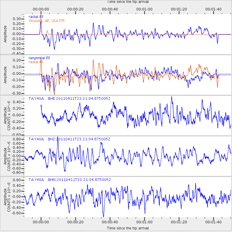
Y40A Okolona, AR, USA - Earthquake Result Viewer
*The percent match for this event was below the threshold and hence no stack was calculated.
| Earthquake location: |
Near East Coast Of Honshu, Japan |
| Earthquake latitude/longitude: |
35.4/140.6 |
| Earthquake time(UTC): |
2011/04/11 (101) 23:08:16 GMT |
| Earthquake Depth: |
15 km |
| Earthquake Magnitude: |
6.0 MB, 6.1 MS, 6.2 MW, 6.2 MW |
| Earthquake Catalog/Contributor: |
WHDF/NEIC |
|
| Network: |
TA USArray Transportable Network (new EarthScope stations) |
| Station: |
Y40A Okolona, AR, USA |
| Lat/Lon: |
34.01 N/93.28 W |
| Elevation: |
117 m |
|
| Distance: |
94.5 deg |
| Az: |
42.289 deg |
| Baz: |
318.575 deg |
| Ray Param: |
$rayparam |
*The percent match for this event was below the threshold and hence was not used in the summary stack. |
|
| Radial Match: |
62.642845 % |
| Radial Bump: |
400 |
| Transverse Match: |
55.668118 % |
| Transverse Bump: |
400 |
| SOD ConfigId: |
356183 |
| Insert Time: |
2011-09-27 11:33:45.465 +0000 |
| GWidth: |
2.5 |
| Max Bumps: |
400 |
| Tol: |
0.001 |
|
Signal To Noise
| Channel | StoN | STA | LTA |
| TA:Y40A: :BHZ:20110411T23:21:04.875005Z | 1.9739909 | 2.3610905E-7 | 1.1961E-7 |
| TA:Y40A: :BHN:20110411T23:21:04.875005Z | 1.1366993 | 1.7841629E-7 | 1.5695997E-7 |
| TA:Y40A: :BHE:20110411T23:21:04.875005Z | 1.2069265 | 1.6060082E-7 | 1.3306595E-7 |
| Arrivals |
| Ps | |
| PpPs | |
| PsPs/PpSs | |


