You are here: Home > Network List > US - United States National Seismic Network Stations List
> Station EGMT Eagleton, Montana, USA > Earthquake Result Viewer
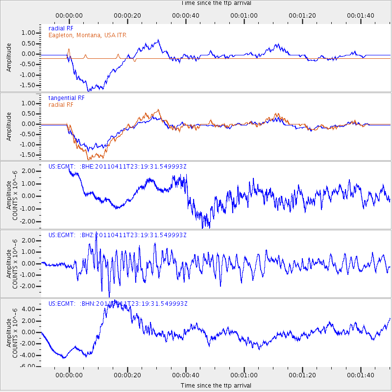
EGMT Eagleton, Montana, USA - Earthquake Result Viewer
*The percent match for this event was below the threshold and hence no stack was calculated.
| Earthquake location: |
Near East Coast Of Honshu, Japan |
| Earthquake latitude/longitude: |
35.4/140.6 |
| Earthquake time(UTC): |
2011/04/11 (101) 23:08:16 GMT |
| Earthquake Depth: |
15 km |
| Earthquake Magnitude: |
6.0 MB, 6.1 MS, 6.2 MW, 6.2 MW |
| Earthquake Catalog/Contributor: |
WHDF/NEIC |
|
| Network: |
US United States National Seismic Network |
| Station: |
EGMT Eagleton, Montana, USA |
| Lat/Lon: |
48.02 N/109.75 W |
| Elevation: |
1055 m |
|
| Distance: |
75.9 deg |
| Az: |
40.667 deg |
| Baz: |
307.543 deg |
| Ray Param: |
$rayparam |
*The percent match for this event was below the threshold and hence was not used in the summary stack. |
|
| Radial Match: |
41.309135 % |
| Radial Bump: |
400 |
| Transverse Match: |
37.526867 % |
| Transverse Bump: |
400 |
| SOD ConfigId: |
356183 |
| Insert Time: |
2011-09-27 11:55:38.333 +0000 |
| GWidth: |
2.5 |
| Max Bumps: |
400 |
| Tol: |
0.001 |
|
Signal To Noise
| Channel | StoN | STA | LTA |
| US:EGMT: :BHZ:20110411T23:19:31.549993Z | 3.5748904 | 5.319261E-7 | 1.4879507E-7 |
| US:EGMT: :BHN:20110411T23:19:31.549993Z | 1.7968696 | 2.5971494E-6 | 1.4453744E-6 |
| US:EGMT: :BHE:20110411T23:19:31.549993Z | 0.6048894 | 5.0027785E-7 | 8.2705674E-7 |
| Arrivals |
| Ps | |
| PpPs | |
| PsPs/PpSs | |


