You are here: Home > Network List > US - United States National Seismic Network Stations List
> Station AGMN Agassiz National Wildlife Refuge, Minnesota, USA > Earthquake Result Viewer
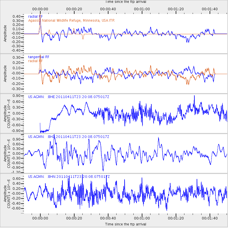
AGMN Agassiz National Wildlife Refuge, Minnesota, USA - Earthquake Result Viewer
*The percent match for this event was below the threshold and hence no stack was calculated.
| Earthquake location: |
Near East Coast Of Honshu, Japan |
| Earthquake latitude/longitude: |
35.4/140.6 |
| Earthquake time(UTC): |
2011/04/11 (101) 23:08:16 GMT |
| Earthquake Depth: |
15 km |
| Earthquake Magnitude: |
6.0 MB, 6.1 MS, 6.2 MW, 6.2 MW |
| Earthquake Catalog/Contributor: |
WHDF/NEIC |
|
| Network: |
US United States National Seismic Network |
| Station: |
AGMN Agassiz National Wildlife Refuge, Minnesota, USA |
| Lat/Lon: |
48.30 N/95.86 W |
| Elevation: |
351 m |
|
| Distance: |
82.6 deg |
| Az: |
34.127 deg |
| Baz: |
316.666 deg |
| Ray Param: |
$rayparam |
*The percent match for this event was below the threshold and hence was not used in the summary stack. |
|
| Radial Match: |
37.231762 % |
| Radial Bump: |
400 |
| Transverse Match: |
40.64818 % |
| Transverse Bump: |
400 |
| SOD ConfigId: |
356183 |
| Insert Time: |
2011-09-27 11:58:09.637 +0000 |
| GWidth: |
2.5 |
| Max Bumps: |
400 |
| Tol: |
0.001 |
|
Signal To Noise
| Channel | StoN | STA | LTA |
| US:AGMN: :BHZ:20110411T23:20:08.075017Z | 2.943129 | 4.3149637E-7 | 1.4661144E-7 |
| US:AGMN: :BHN:20110411T23:20:08.075017Z | 1.4048275 | 1.9927353E-7 | 1.4184911E-7 |
| US:AGMN: :BHE:20110411T23:20:08.075017Z | 0.42412096 | 1.9265956E-7 | 4.5425617E-7 |
| Arrivals |
| Ps | |
| PpPs | |
| PsPs/PpSs | |


