You are here: Home > Network List > CI - Caltech Regional Seismic Network Stations List
> Station MPP McPhearson Peak > Earthquake Result Viewer
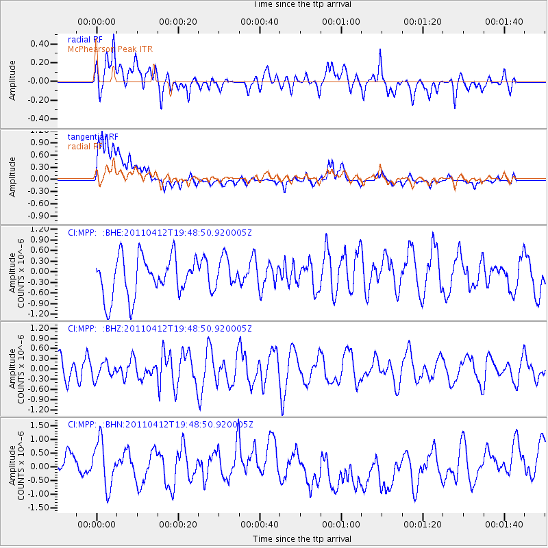
MPP McPhearson Peak - Earthquake Result Viewer
*The percent match for this event was below the threshold and hence no stack was calculated.
| Earthquake location: |
Eastern Honshu, Japan |
| Earthquake latitude/longitude: |
39.4/141.9 |
| Earthquake time(UTC): |
2011/04/12 (102) 19:37:48 GMT |
| Earthquake Depth: |
45 km |
| Earthquake Magnitude: |
5.6 MB, 5.0 MS, 5.6 MW, 5.6 MW |
| Earthquake Catalog/Contributor: |
WHDF/NEIC |
|
| Network: |
CI Caltech Regional Seismic Network |
| Station: |
MPP McPhearson Peak |
| Lat/Lon: |
34.89 N/119.81 W |
| Elevation: |
1739 m |
|
| Distance: |
74.5 deg |
| Az: |
57.599 deg |
| Baz: |
307.236 deg |
| Ray Param: |
$rayparam |
*The percent match for this event was below the threshold and hence was not used in the summary stack. |
|
| Radial Match: |
44.825985 % |
| Radial Bump: |
400 |
| Transverse Match: |
42.52283 % |
| Transverse Bump: |
400 |
| SOD ConfigId: |
356183 |
| Insert Time: |
2011-09-27 12:53:24.354 +0000 |
| GWidth: |
2.5 |
| Max Bumps: |
400 |
| Tol: |
0.001 |
|
Signal To Noise
| Channel | StoN | STA | LTA |
| CI:MPP: :BHZ:20110412T19:48:50.920005Z | 0.5035479 | 2.3872815E-7 | 4.7409222E-7 |
| CI:MPP: :BHN:20110412T19:48:50.920005Z | 1.0059835 | 1.0854955E-6 | 1.0790391E-6 |
| CI:MPP: :BHE:20110412T19:48:50.920005Z | 0.75244826 | 4.2548112E-7 | 5.654623E-7 |
| Arrivals |
| Ps | |
| PpPs | |
| PsPs/PpSs | |


