You are here: Home > Network List > KN - Kyrgyz Seismic Telemetry Network Stations List
> Station CHM KN.CHM > Earthquake Result Viewer
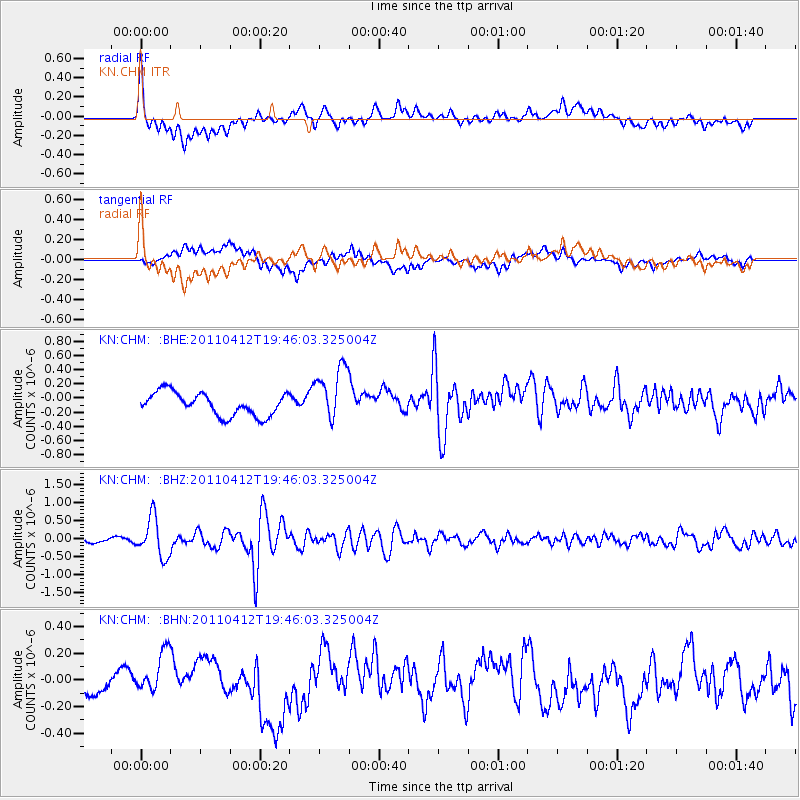
CHM KN.CHM - Earthquake Result Viewer
*The percent match for this event was below the threshold and hence no stack was calculated.
| Earthquake location: |
Eastern Honshu, Japan |
| Earthquake latitude/longitude: |
39.4/141.9 |
| Earthquake time(UTC): |
2011/04/12 (102) 19:37:48 GMT |
| Earthquake Depth: |
45 km |
| Earthquake Magnitude: |
5.6 MB, 5.0 MS, 5.6 MW, 5.6 MW |
| Earthquake Catalog/Contributor: |
WHDF/NEIC |
|
| Network: |
KN Kyrgyz Seismic Telemetry Network |
| Station: |
CHM KN.CHM |
| Lat/Lon: |
43.00 N/74.75 E |
| Elevation: |
655 m |
|
| Distance: |
49.4 deg |
| Az: |
297.152 deg |
| Baz: |
70.078 deg |
| Ray Param: |
$rayparam |
*The percent match for this event was below the threshold and hence was not used in the summary stack. |
|
| Radial Match: |
61.740303 % |
| Radial Bump: |
400 |
| Transverse Match: |
65.56442 % |
| Transverse Bump: |
400 |
| SOD ConfigId: |
356183 |
| Insert Time: |
2011-09-27 12:59:50.714 +0000 |
| GWidth: |
2.5 |
| Max Bumps: |
400 |
| Tol: |
0.001 |
|
Signal To Noise
| Channel | StoN | STA | LTA |
| KN:CHM: :BHZ:20110412T19:46:03.325004Z | 4.497979 | 5.4353296E-7 | 1.2083937E-7 |
| KN:CHM: :BHN:20110412T19:46:03.325004Z | 2.2030377 | 1.8004678E-7 | 8.17266E-8 |
| KN:CHM: :BHE:20110412T19:46:03.325004Z | 2.4549692 | 3.9493656E-7 | 1.608723E-7 |
| Arrivals |
| Ps | |
| PpPs | |
| PsPs/PpSs | |


