You are here: Home > Network List > AZ - ANZA Regional Network Stations List
> Station SMER AZ.SMER > Earthquake Result Viewer
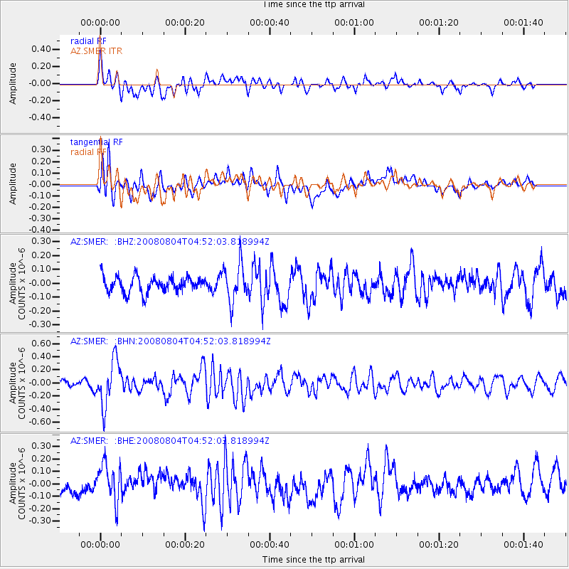
SMER AZ.SMER - Earthquake Result Viewer
*The percent match for this event was below the threshold and hence no stack was calculated.
| Earthquake location: |
Kuril Islands |
| Earthquake latitude/longitude: |
49.9/156.4 |
| Earthquake time(UTC): |
2008/08/04 (217) 04:42:14 GMT |
| Earthquake Depth: |
77 km |
| Earthquake Magnitude: |
5.6 MB, 5.8 MW, 5.7 MW |
| Earthquake Catalog/Contributor: |
WHDF/NEIC |
|
| Network: |
AZ ANZA Regional Network |
| Station: |
SMER AZ.SMER |
| Lat/Lon: |
33.46 N/117.17 W |
| Elevation: |
355 m |
|
| Distance: |
63.1 deg |
| Az: |
69.273 deg |
| Baz: |
313.6 deg |
| Ray Param: |
$rayparam |
*The percent match for this event was below the threshold and hence was not used in the summary stack. |
|
| Radial Match: |
68.957504 % |
| Radial Bump: |
400 |
| Transverse Match: |
61.70554 % |
| Transverse Bump: |
400 |
| SOD ConfigId: |
2504 |
| Insert Time: |
2010-02-26 20:47:17.674 +0000 |
| GWidth: |
2.5 |
| Max Bumps: |
400 |
| Tol: |
0.001 |
|
Signal To Noise
| Channel | StoN | STA | LTA |
| AZ:SMER: :BHN:20080804T04:52:03.818994Z | 3.867835 | 3.5055584E-7 | 9.0633606E-8 |
| AZ:SMER: :BHE:20080804T04:52:03.818994Z | 1.65387 | 1.5508651E-7 | 9.377189E-8 |
| AZ:SMER: :BHZ:20080804T04:52:03.818994Z | 2.4500804 | 1.3914185E-7 | 5.679072E-8 |
| Arrivals |
| Ps | |
| PpPs | |
| PsPs/PpSs | |


