You are here: Home > Network List > AZ - ANZA Regional Network Stations List
> Station SMER AZ.SMER > Earthquake Result Viewer
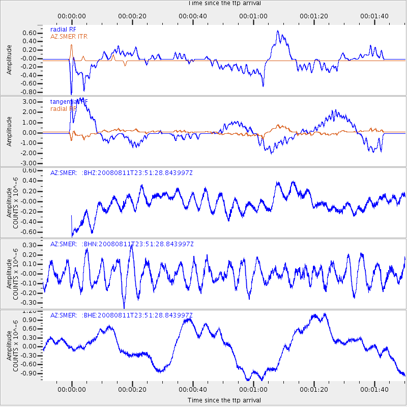
SMER AZ.SMER - Earthquake Result Viewer
*The percent match for this event was below the threshold and hence no stack was calculated.
| Earthquake location: |
Central Mid-Atlantic Ridge |
| Earthquake latitude/longitude: |
-1.0/-21.8 |
| Earthquake time(UTC): |
2008/08/11 (224) 23:38:38 GMT |
| Earthquake Depth: |
13 km |
| Earthquake Magnitude: |
6.0 MW, 5.2 MS, 5.4 MB, 6.0 MW |
| Earthquake Catalog/Contributor: |
WHDF/NEIC |
|
| Network: |
AZ ANZA Regional Network |
| Station: |
SMER AZ.SMER |
| Lat/Lon: |
33.46 N/117.17 W |
| Elevation: |
355 m |
|
| Distance: |
95.0 deg |
| Az: |
303.325 deg |
| Baz: |
87.92 deg |
| Ray Param: |
$rayparam |
*The percent match for this event was below the threshold and hence was not used in the summary stack. |
|
| Radial Match: |
37.80828 % |
| Radial Bump: |
400 |
| Transverse Match: |
56.545662 % |
| Transverse Bump: |
400 |
| SOD ConfigId: |
2504 |
| Insert Time: |
2010-02-26 20:47:19.493 +0000 |
| GWidth: |
2.5 |
| Max Bumps: |
400 |
| Tol: |
0.001 |
|
Signal To Noise
| Channel | StoN | STA | LTA |
| AZ:SMER: :BHN:20080811T23:51:28.843997Z | 1.0861441 | 1.1412187E-7 | 1.05070654E-7 |
| AZ:SMER: :BHE:20080811T23:51:28.843997Z | 1.0435445 | 3.0222932E-7 | 2.8961804E-7 |
| AZ:SMER: :BHZ:20080811T23:51:28.843997Z | 1.1851295 | 2.8405037E-7 | 2.3967877E-7 |
| Arrivals |
| Ps | |
| PpPs | |
| PsPs/PpSs | |


