You are here: Home > Network List > TA - USArray Transportable Network (new EarthScope stations) Stations List
> Station U34A Anderson Ranch, Garber, OK, USA > Earthquake Result Viewer
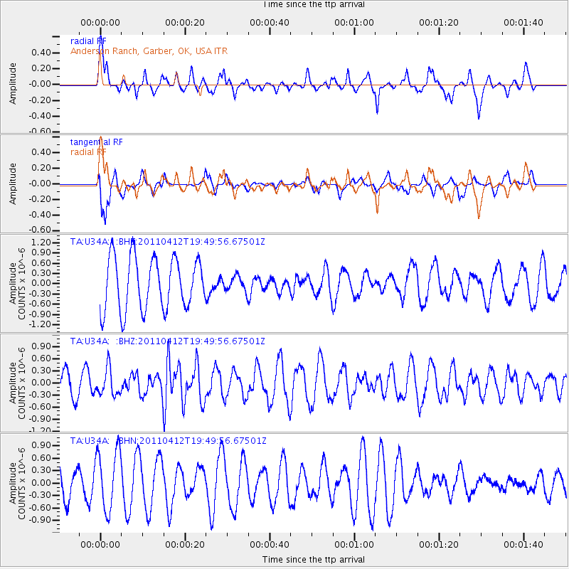
U34A Anderson Ranch, Garber, OK, USA - Earthquake Result Viewer
*The percent match for this event was below the threshold and hence no stack was calculated.
| Earthquake location: |
Eastern Honshu, Japan |
| Earthquake latitude/longitude: |
39.4/141.9 |
| Earthquake time(UTC): |
2011/04/12 (102) 19:37:48 GMT |
| Earthquake Depth: |
45 km |
| Earthquake Magnitude: |
5.6 MB, 5.0 MS, 5.6 MW, 5.6 MW |
| Earthquake Catalog/Contributor: |
WHDF/NEIC |
|
| Network: |
TA USArray Transportable Network (new EarthScope stations) |
| Station: |
U34A Anderson Ranch, Garber, OK, USA |
| Lat/Lon: |
36.44 N/97.54 W |
| Elevation: |
345 m |
|
| Distance: |
86.8 deg |
| Az: |
44.06 deg |
| Baz: |
318.051 deg |
| Ray Param: |
$rayparam |
*The percent match for this event was below the threshold and hence was not used in the summary stack. |
|
| Radial Match: |
62.84808 % |
| Radial Bump: |
400 |
| Transverse Match: |
85.89281 % |
| Transverse Bump: |
400 |
| SOD ConfigId: |
356183 |
| Insert Time: |
2011-09-27 13:16:06.163 +0000 |
| GWidth: |
2.5 |
| Max Bumps: |
400 |
| Tol: |
0.001 |
|
Signal To Noise
| Channel | StoN | STA | LTA |
| TA:U34A: :BHZ:20110412T19:49:56.67501Z | 0.57426924 | 3.3809644E-7 | 5.8874207E-7 |
| TA:U34A: :BHN:20110412T19:49:56.67501Z | 1.8660941 | 7.320826E-7 | 3.9230744E-7 |
| TA:U34A: :BHE:20110412T19:49:56.67501Z | 0.28797558 | 2.2029778E-7 | 7.649877E-7 |
| Arrivals |
| Ps | |
| PpPs | |
| PsPs/PpSs | |


