You are here: Home > Network List > TA - USArray Transportable Network (new EarthScope stations) Stations List
> Station E36A McGregor, MN, USA > Earthquake Result Viewer
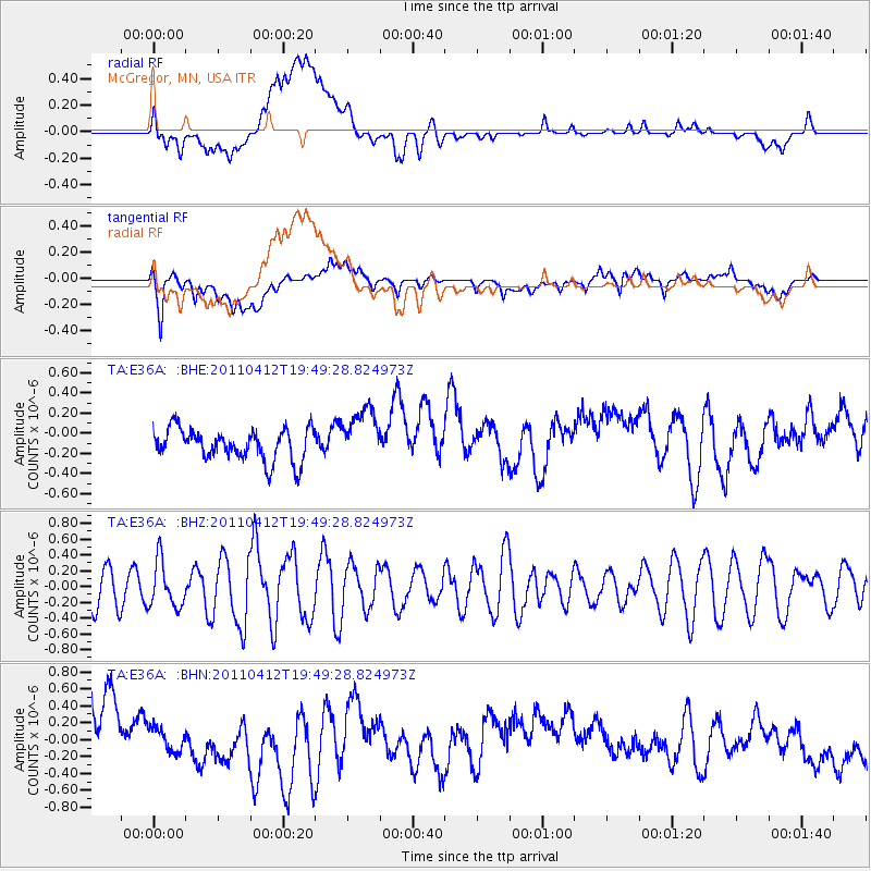
E36A McGregor, MN, USA - Earthquake Result Viewer
*The percent match for this event was below the threshold and hence no stack was calculated.
| Earthquake location: |
Eastern Honshu, Japan |
| Earthquake latitude/longitude: |
39.4/141.9 |
| Earthquake time(UTC): |
2011/04/12 (102) 19:37:48 GMT |
| Earthquake Depth: |
45 km |
| Earthquake Magnitude: |
5.6 MB, 5.0 MS, 5.6 MW, 5.6 MW |
| Earthquake Catalog/Contributor: |
WHDF/NEIC |
|
| Network: |
TA USArray Transportable Network (new EarthScope stations) |
| Station: |
E36A McGregor, MN, USA |
| Lat/Lon: |
46.52 N/93.26 W |
| Elevation: |
393 m |
|
| Distance: |
81.3 deg |
| Az: |
34.98 deg |
| Baz: |
319.944 deg |
| Ray Param: |
$rayparam |
*The percent match for this event was below the threshold and hence was not used in the summary stack. |
|
| Radial Match: |
32.406517 % |
| Radial Bump: |
400 |
| Transverse Match: |
54.6391 % |
| Transverse Bump: |
400 |
| SOD ConfigId: |
356183 |
| Insert Time: |
2011-09-27 13:23:37.737 +0000 |
| GWidth: |
2.5 |
| Max Bumps: |
400 |
| Tol: |
0.001 |
|
Signal To Noise
| Channel | StoN | STA | LTA |
| TA:E36A: :BHZ:20110412T19:49:28.824973Z | 1.0956281 | 2.8854558E-7 | 2.6336087E-7 |
| TA:E36A: :BHN:20110412T19:49:28.824973Z | 0.3325611 | 1.439332E-7 | 4.3280227E-7 |
| TA:E36A: :BHE:20110412T19:49:28.824973Z | 1.7573051 | 2.7354798E-7 | 1.5566333E-7 |
| Arrivals |
| Ps | |
| PpPs | |
| PsPs/PpSs | |


