You are here: Home > Network List > AZ - ANZA Regional Network Stations List
> Station SMER AZ.SMER > Earthquake Result Viewer
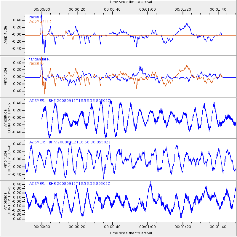
SMER AZ.SMER - Earthquake Result Viewer
*The percent match for this event was below the threshold and hence no stack was calculated.
| Earthquake location: |
Southeast Of Loyalty Islands |
| Earthquake latitude/longitude: |
-21.7/170.5 |
| Earthquake time(UTC): |
2008/09/12 (256) 16:44:30 GMT |
| Earthquake Depth: |
116 km |
| Earthquake Magnitude: |
5.8 MW, 5.4 MB, 5.8 MW |
| Earthquake Catalog/Contributor: |
WHDF/NEIC |
|
| Network: |
AZ ANZA Regional Network |
| Station: |
SMER AZ.SMER |
| Lat/Lon: |
33.46 N/117.17 W |
| Elevation: |
355 m |
|
| Distance: |
88.0 deg |
| Az: |
52.858 deg |
| Baz: |
242.482 deg |
| Ray Param: |
$rayparam |
*The percent match for this event was below the threshold and hence was not used in the summary stack. |
|
| Radial Match: |
65.91199 % |
| Radial Bump: |
400 |
| Transverse Match: |
53.39573 % |
| Transverse Bump: |
400 |
| SOD ConfigId: |
2560 |
| Insert Time: |
2010-02-26 20:47:31.559 +0000 |
| GWidth: |
2.5 |
| Max Bumps: |
400 |
| Tol: |
0.001 |
|
Signal To Noise
| Channel | StoN | STA | LTA |
| AZ:SMER: :BHN:20080912T16:56:36.89502Z | 0.8866794 | 1.4890163E-7 | 1.6793176E-7 |
| AZ:SMER: :BHE:20080912T16:56:36.89502Z | 1.0893679 | 1.1258213E-7 | 1.03346295E-7 |
| AZ:SMER: :BHZ:20080912T16:56:36.89502Z | 1.3360981 | 2.8969777E-7 | 2.1682372E-7 |
| Arrivals |
| Ps | |
| PpPs | |
| PsPs/PpSs | |


