You are here: Home > Network List > AZ - ANZA Regional Network Stations List
> Station SMER AZ.SMER > Earthquake Result Viewer
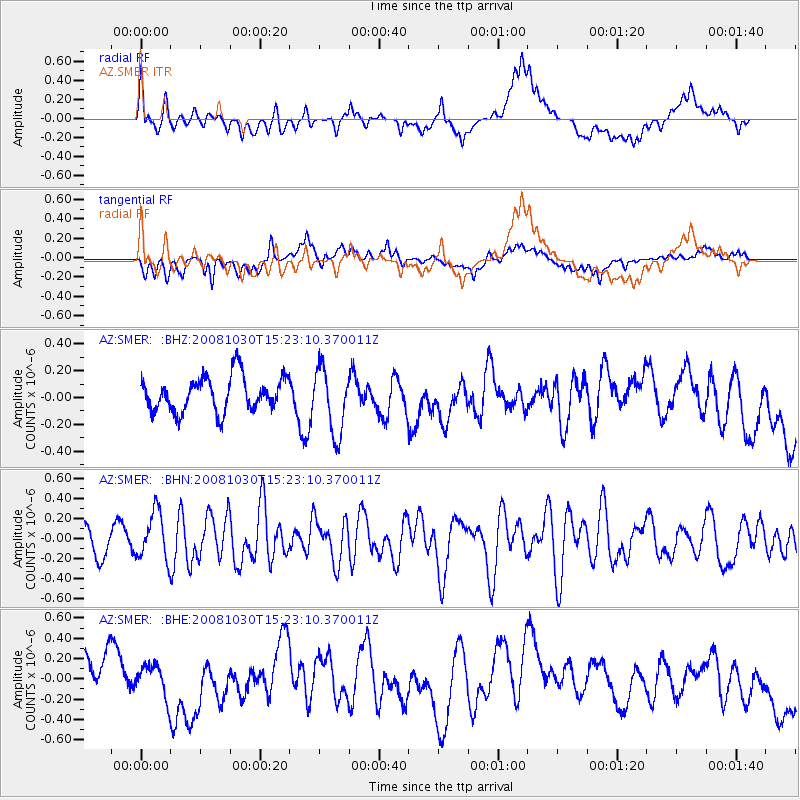
SMER AZ.SMER - Earthquake Result Viewer
*The percent match for this event was below the threshold and hence no stack was calculated.
| Earthquake location: |
Central East Pacific Rise |
| Earthquake latitude/longitude: |
-9.0/-108.2 |
| Earthquake time(UTC): |
2008/10/30 (304) 15:15:41 GMT |
| Earthquake Depth: |
10 km |
| Earthquake Magnitude: |
5.5 MB, 5.8 MS, 6.0 MW, 6.0 MW |
| Earthquake Catalog/Contributor: |
WHDF/NEIC |
|
| Network: |
AZ ANZA Regional Network |
| Station: |
SMER AZ.SMER |
| Lat/Lon: |
33.46 N/117.17 W |
| Elevation: |
355 m |
|
| Distance: |
43.1 deg |
| Az: |
349.055 deg |
| Baz: |
167.036 deg |
| Ray Param: |
$rayparam |
*The percent match for this event was below the threshold and hence was not used in the summary stack. |
|
| Radial Match: |
55.299644 % |
| Radial Bump: |
400 |
| Transverse Match: |
50.355633 % |
| Transverse Bump: |
400 |
| SOD ConfigId: |
2560 |
| Insert Time: |
2010-02-26 20:47:38.900 +0000 |
| GWidth: |
2.5 |
| Max Bumps: |
400 |
| Tol: |
0.001 |
|
Signal To Noise
| Channel | StoN | STA | LTA |
| AZ:SMER: :BHN:20081030T15:23:10.370011Z | 2.440119 | 2.436452E-7 | 9.984971E-8 |
| AZ:SMER: :BHE:20081030T15:23:10.370011Z | 0.5424241 | 1.5879735E-7 | 2.9275495E-7 |
| AZ:SMER: :BHZ:20081030T15:23:10.370011Z | 1.9372777 | 2.4740197E-7 | 1.27706E-7 |
| Arrivals |
| Ps | |
| PpPs | |
| PsPs/PpSs | |


