You are here: Home > Network List > AZ - ANZA Regional Network Stations List
> Station SMER AZ.SMER > Earthquake Result Viewer
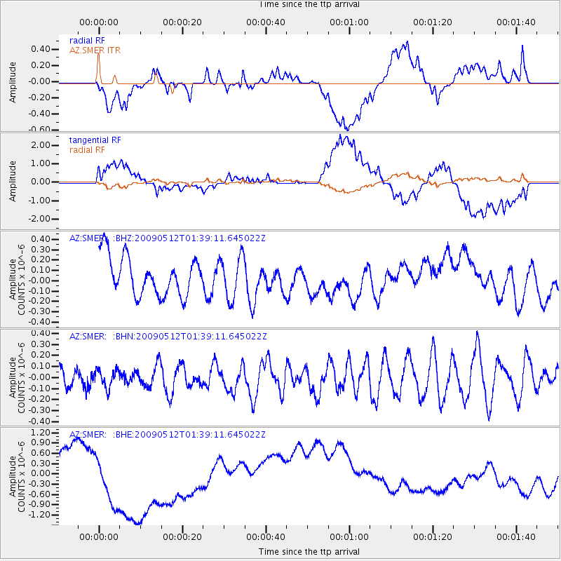
SMER AZ.SMER - Earthquake Result Viewer
*The percent match for this event was below the threshold and hence no stack was calculated.
| Earthquake location: |
New Britain Region, P.N.G. |
| Earthquake latitude/longitude: |
-5.7/149.5 |
| Earthquake time(UTC): |
2009/05/12 (132) 01:26:26 GMT |
| Earthquake Depth: |
84 km |
| Earthquake Magnitude: |
5.9 MB, 6.1 MW, 6.1 MW |
| Earthquake Catalog/Contributor: |
WHDF/NEIC |
|
| Network: |
AZ ANZA Regional Network |
| Station: |
SMER AZ.SMER |
| Lat/Lon: |
33.46 N/117.17 W |
| Elevation: |
355 m |
|
| Distance: |
95.8 deg |
| Az: |
57.028 deg |
| Baz: |
267.09 deg |
| Ray Param: |
$rayparam |
*The percent match for this event was below the threshold and hence was not used in the summary stack. |
|
| Radial Match: |
50.617775 % |
| Radial Bump: |
400 |
| Transverse Match: |
47.950523 % |
| Transverse Bump: |
400 |
| SOD ConfigId: |
2760 |
| Insert Time: |
2010-02-26 20:47:42.483 +0000 |
| GWidth: |
2.5 |
| Max Bumps: |
400 |
| Tol: |
0.001 |
|
Signal To Noise
| Channel | StoN | STA | LTA |
| AZ:SMER: :BHN:20090512T01:39:11.645022Z | 1.0423102 | 8.1441314E-8 | 7.8135386E-8 |
| AZ:SMER: :BHE:20090512T01:39:11.645022Z | 2.0288227 | 1.3076989E-6 | 6.445605E-7 |
| AZ:SMER: :BHZ:20090512T01:39:11.645022Z | 1.1283919 | 2.0941066E-7 | 1.8558327E-7 |
| Arrivals |
| Ps | |
| PpPs | |
| PsPs/PpSs | |


