You are here: Home > Network List > TA - USArray Transportable Network (new EarthScope stations) Stations List
> Station H17A Grant Village (NPS), Yellowstone Nt. Park, WY, USA > Earthquake Result Viewer
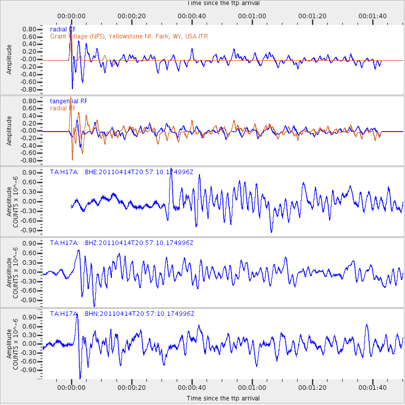
H17A Grant Village (NPS), Yellowstone Nt. Park, WY, USA - Earthquake Result Viewer
*The percent match for this event was below the threshold and hence no stack was calculated.
| Earthquake location: |
Near Coast Of Nicaragua |
| Earthquake latitude/longitude: |
11.2/-86.4 |
| Earthquake time(UTC): |
2011/04/14 (104) 20:50:16 GMT |
| Earthquake Depth: |
35 km |
| Earthquake Magnitude: |
5.6 MB, 5.4 MS, 5.7 MW, 5.6 MW |
| Earthquake Catalog/Contributor: |
WHDF/NEIC |
|
| Network: |
TA USArray Transportable Network (new EarthScope stations) |
| Station: |
H17A Grant Village (NPS), Yellowstone Nt. Park, WY, USA |
| Lat/Lon: |
44.40 N/110.58 W |
| Elevation: |
2400 m |
|
| Distance: |
39.1 deg |
| Az: |
332.218 deg |
| Baz: |
140.354 deg |
| Ray Param: |
$rayparam |
*The percent match for this event was below the threshold and hence was not used in the summary stack. |
|
| Radial Match: |
63.35771 % |
| Radial Bump: |
400 |
| Transverse Match: |
69.637405 % |
| Transverse Bump: |
400 |
| SOD ConfigId: |
356183 |
| Insert Time: |
2011-09-27 16:28:18.687 +0000 |
| GWidth: |
2.5 |
| Max Bumps: |
400 |
| Tol: |
0.001 |
|
Signal To Noise
| Channel | StoN | STA | LTA |
| TA:H17A: :BHZ:20110414T20:57:10.174996Z | 5.047532 | 4.2439004E-7 | 8.407872E-8 |
| TA:H17A: :BHN:20110414T20:57:10.174996Z | 3.6801898 | 5.187285E-7 | 1.4095156E-7 |
| TA:H17A: :BHE:20110414T20:57:10.174996Z | 3.2405016 | 4.0564893E-7 | 1.251809E-7 |
| Arrivals |
| Ps | |
| PpPs | |
| PsPs/PpSs | |


