You are here: Home > Network List > TA - USArray Transportable Network (new EarthScope stations) Stations List
> Station F27A Lemmon, SD, USA > Earthquake Result Viewer
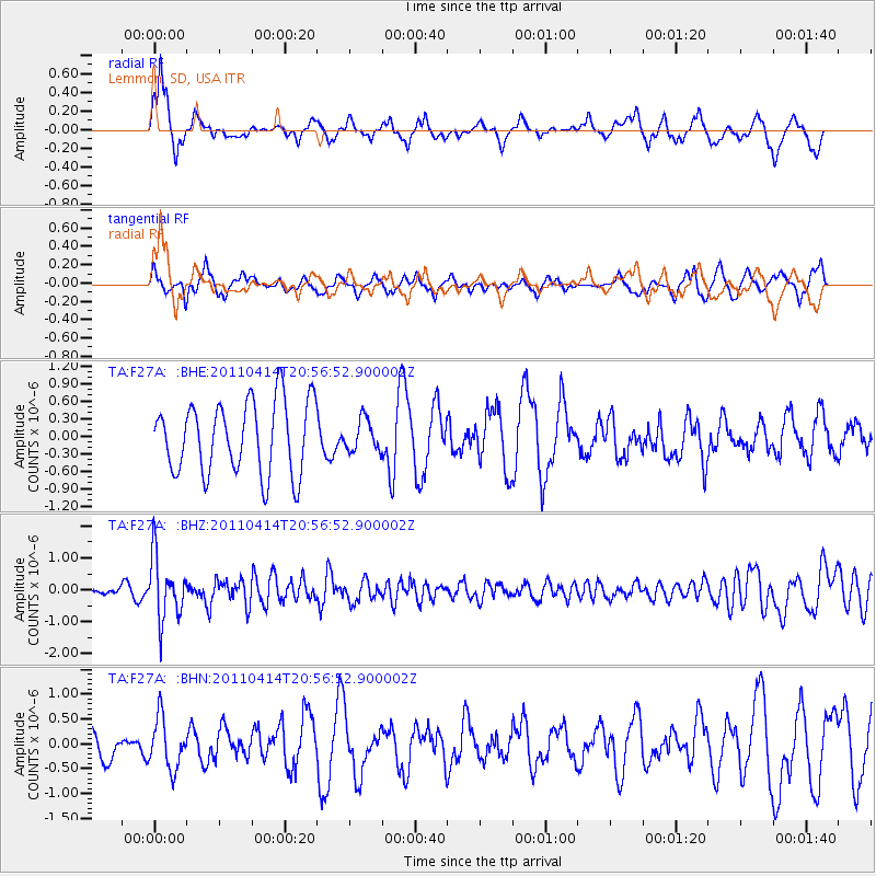
F27A Lemmon, SD, USA - Earthquake Result Viewer
*The percent match for this event was below the threshold and hence no stack was calculated.
| Earthquake location: |
Near Coast Of Nicaragua |
| Earthquake latitude/longitude: |
11.2/-86.4 |
| Earthquake time(UTC): |
2011/04/14 (104) 20:50:16 GMT |
| Earthquake Depth: |
35 km |
| Earthquake Magnitude: |
5.6 MB, 5.4 MS, 5.7 MW, 5.6 MW |
| Earthquake Catalog/Contributor: |
WHDF/NEIC |
|
| Network: |
TA USArray Transportable Network (new EarthScope stations) |
| Station: |
F27A Lemmon, SD, USA |
| Lat/Lon: |
45.87 N/102.02 W |
| Elevation: |
757 m |
|
| Distance: |
37.1 deg |
| Az: |
341.761 deg |
| Baz: |
153.922 deg |
| Ray Param: |
$rayparam |
*The percent match for this event was below the threshold and hence was not used in the summary stack. |
|
| Radial Match: |
68.12725 % |
| Radial Bump: |
378 |
| Transverse Match: |
47.766624 % |
| Transverse Bump: |
396 |
| SOD ConfigId: |
356183 |
| Insert Time: |
2011-09-27 16:35:50.613 +0000 |
| GWidth: |
2.5 |
| Max Bumps: |
400 |
| Tol: |
0.001 |
|
Signal To Noise
| Channel | StoN | STA | LTA |
| TA:F27A: :BHZ:20110414T20:56:52.900002Z | 5.1060653 | 9.734082E-7 | 1.9063764E-7 |
| TA:F27A: :BHN:20110414T20:56:52.900002Z | 1.7607516 | 5.076823E-7 | 2.883327E-7 |
| TA:F27A: :BHE:20110414T20:56:52.900002Z | 0.4338715 | 2.6773947E-7 | 6.170939E-7 |
| Arrivals |
| Ps | |
| PpPs | |
| PsPs/PpSs | |


