You are here: Home > Network List > AZ - ANZA Regional Network Stations List
> Station SMER AZ.SMER > Earthquake Result Viewer
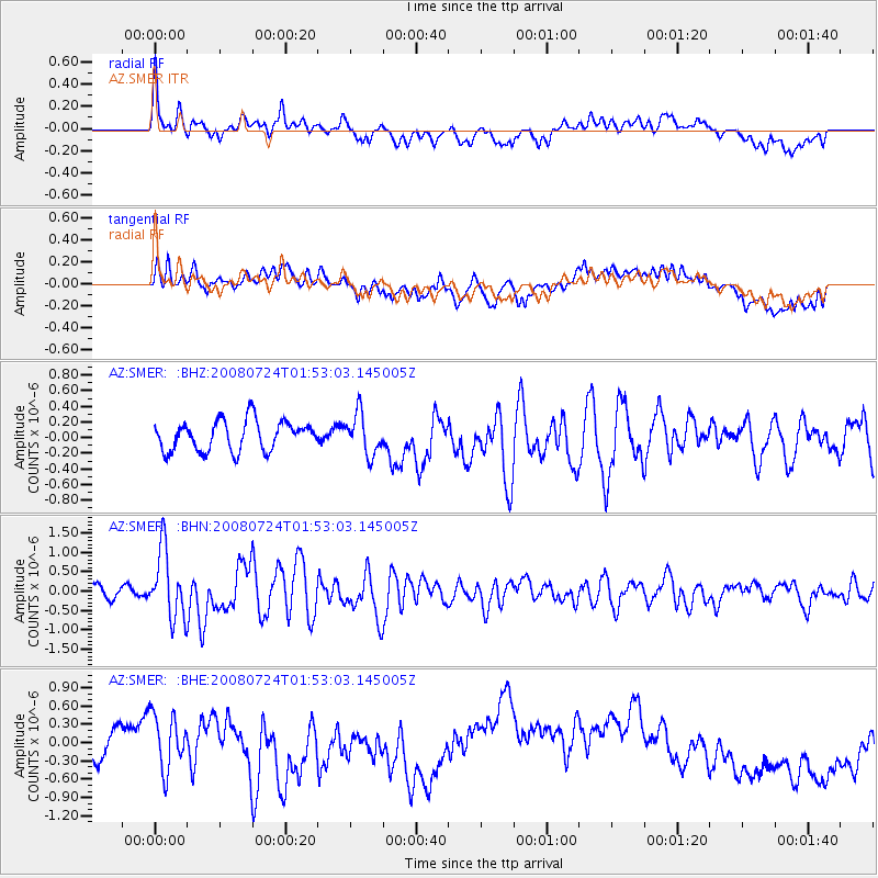
SMER AZ.SMER - Earthquake Result Viewer
*The percent match for this event was below the threshold and hence no stack was calculated.
| Earthquake location: |
Kuril Islands |
| Earthquake latitude/longitude: |
51.0/157.6 |
| Earthquake time(UTC): |
2008/07/24 (206) 01:43:16 GMT |
| Earthquake Depth: |
27 km |
| Earthquake Magnitude: |
6.0 MB, 6.0 MS, 6.2 MW, 6.2 MW |
| Earthquake Catalog/Contributor: |
WHDF/NEIC |
|
| Network: |
AZ ANZA Regional Network |
| Station: |
SMER AZ.SMER |
| Lat/Lon: |
33.46 N/117.17 W |
| Elevation: |
355 m |
|
| Distance: |
62.0 deg |
| Az: |
70.605 deg |
| Baz: |
314.484 deg |
| Ray Param: |
$rayparam |
*The percent match for this event was below the threshold and hence was not used in the summary stack. |
|
| Radial Match: |
60.877037 % |
| Radial Bump: |
400 |
| Transverse Match: |
57.987553 % |
| Transverse Bump: |
400 |
| SOD ConfigId: |
2504 |
| Insert Time: |
2010-02-26 20:48:06.775 +0000 |
| GWidth: |
2.5 |
| Max Bumps: |
400 |
| Tol: |
0.001 |
|
Signal To Noise
| Channel | StoN | STA | LTA |
| AZ:SMER: :BHN:20080724T01:53:03.145005Z | 6.2876105 | 8.8132265E-7 | 1.4016813E-7 |
| AZ:SMER: :BHE:20080724T01:53:03.145005Z | 1.7296273 | 4.4843512E-7 | 2.592669E-7 |
| AZ:SMER: :BHZ:20080724T01:53:03.145005Z | 1.3704997 | 2.6164037E-7 | 1.9090875E-7 |
| Arrivals |
| Ps | |
| PpPs | |
| PsPs/PpSs | |


