You are here: Home > Network List > TA - USArray Transportable Network (new EarthScope stations) Stations List
> Station N35A Tabor, IA, USA > Earthquake Result Viewer
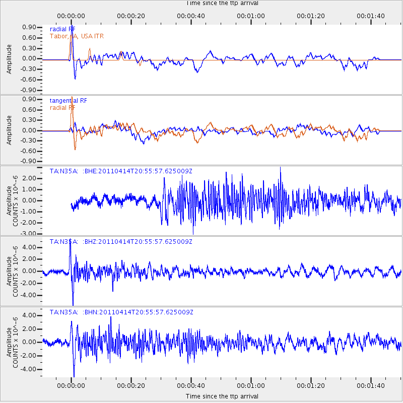
N35A Tabor, IA, USA - Earthquake Result Viewer
*The percent match for this event was below the threshold and hence no stack was calculated.
| Earthquake location: |
Near Coast Of Nicaragua |
| Earthquake latitude/longitude: |
11.2/-86.4 |
| Earthquake time(UTC): |
2011/04/14 (104) 20:50:16 GMT |
| Earthquake Depth: |
35 km |
| Earthquake Magnitude: |
5.6 MB, 5.4 MS, 5.7 MW, 5.6 MW |
| Earthquake Catalog/Contributor: |
WHDF/NEIC |
|
| Network: |
TA USArray Transportable Network (new EarthScope stations) |
| Station: |
N35A Tabor, IA, USA |
| Lat/Lon: |
40.86 N/95.64 W |
| Elevation: |
353 m |
|
| Distance: |
30.7 deg |
| Az: |
346.117 deg |
| Baz: |
161.915 deg |
| Ray Param: |
$rayparam |
*The percent match for this event was below the threshold and hence was not used in the summary stack. |
|
| Radial Match: |
76.3673 % |
| Radial Bump: |
400 |
| Transverse Match: |
62.69011 % |
| Transverse Bump: |
400 |
| SOD ConfigId: |
356183 |
| Insert Time: |
2011-09-27 16:51:12.879 +0000 |
| GWidth: |
2.5 |
| Max Bumps: |
400 |
| Tol: |
0.001 |
|
Signal To Noise
| Channel | StoN | STA | LTA |
| TA:N35A: :BHZ:20110414T20:55:57.625009Z | 10.087444 | 1.9863019E-6 | 1.9690835E-7 |
| TA:N35A: :BHN:20110414T20:55:57.625009Z | 6.1638556 | 1.8372638E-6 | 2.9807055E-7 |
| TA:N35A: :BHE:20110414T20:55:57.625009Z | 3.5434096 | 1.0758258E-6 | 3.0361318E-7 |
| Arrivals |
| Ps | |
| PpPs | |
| PsPs/PpSs | |


