You are here: Home > Network List > TA - USArray Transportable Network (new EarthScope stations) Stations List
> Station C33A Trail, MN, USA > Earthquake Result Viewer
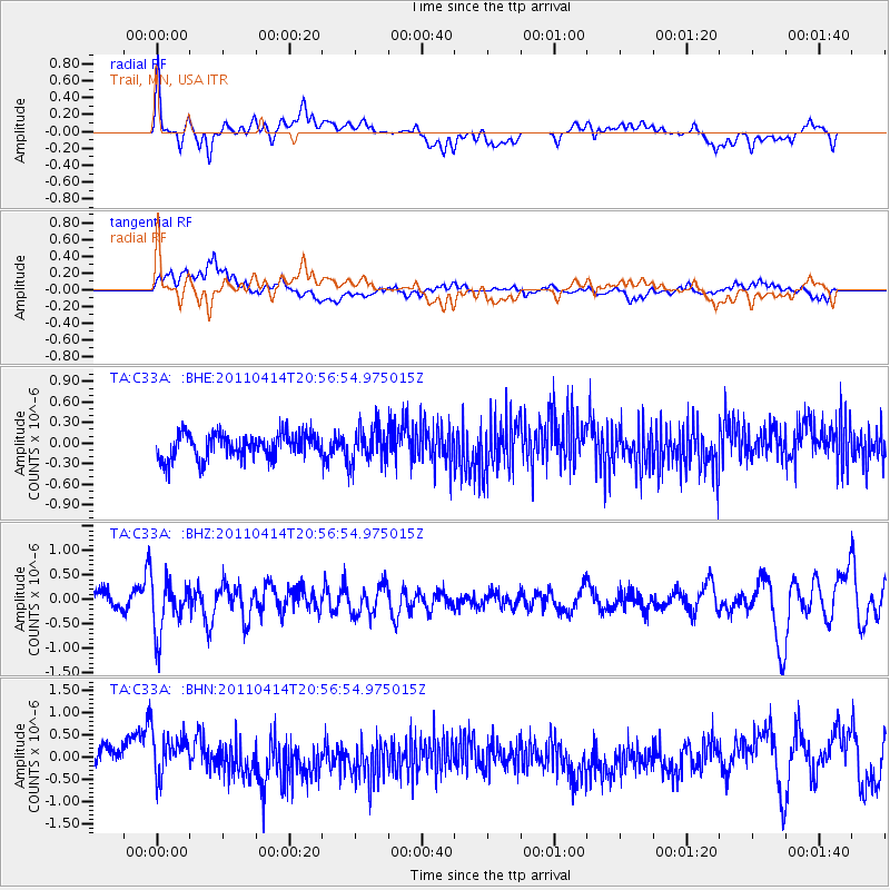
C33A Trail, MN, USA - Earthquake Result Viewer
*The percent match for this event was below the threshold and hence no stack was calculated.
| Earthquake location: |
Near Coast Of Nicaragua |
| Earthquake latitude/longitude: |
11.2/-86.4 |
| Earthquake time(UTC): |
2011/04/14 (104) 20:50:16 GMT |
| Earthquake Depth: |
35 km |
| Earthquake Magnitude: |
5.6 MB, 5.4 MS, 5.7 MW, 5.6 MW |
| Earthquake Catalog/Contributor: |
WHDF/NEIC |
|
| Network: |
TA USArray Transportable Network (new EarthScope stations) |
| Station: |
C33A Trail, MN, USA |
| Lat/Lon: |
47.76 N/95.77 W |
| Elevation: |
388 m |
|
| Distance: |
37.3 deg |
| Az: |
349.504 deg |
| Baz: |
164.637 deg |
| Ray Param: |
$rayparam |
*The percent match for this event was below the threshold and hence was not used in the summary stack. |
|
| Radial Match: |
62.17326 % |
| Radial Bump: |
400 |
| Transverse Match: |
64.19019 % |
| Transverse Bump: |
400 |
| SOD ConfigId: |
356183 |
| Insert Time: |
2011-09-27 17:06:09.622 +0000 |
| GWidth: |
2.5 |
| Max Bumps: |
400 |
| Tol: |
0.001 |
|
Signal To Noise
| Channel | StoN | STA | LTA |
| TA:C33A: :BHZ:20110414T20:56:54.975015Z | 3.3780327 | 5.386994E-7 | 1.5947134E-7 |
| TA:C33A: :BHN:20110414T20:56:54.975015Z | 2.2604048 | 5.3728047E-7 | 2.3769215E-7 |
| TA:C33A: :BHE:20110414T20:56:54.975015Z | 1.4576026 | 2.6064026E-7 | 1.7881435E-7 |
| Arrivals |
| Ps | |
| PpPs | |
| PsPs/PpSs | |


