You are here: Home > Network List > AZ - ANZA Regional Network Stations List
> Station SMER AZ.SMER > Earthquake Result Viewer
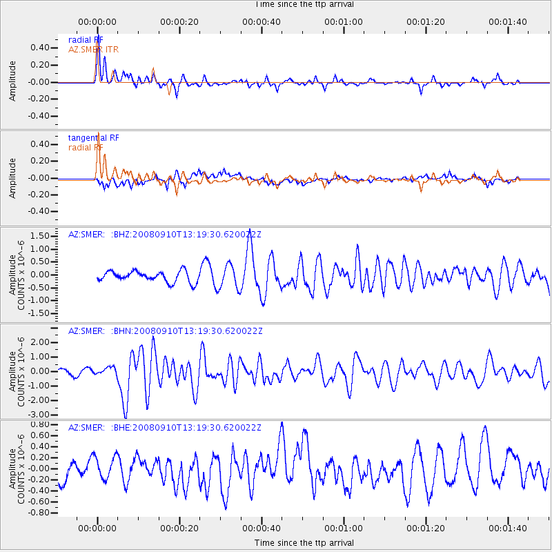
SMER AZ.SMER - Earthquake Result Viewer
*The percent match for this event was below the threshold and hence no stack was calculated.
| Earthquake location: |
Central Mid-Atlantic Ridge |
| Earthquake latitude/longitude: |
8.1/-38.7 |
| Earthquake time(UTC): |
2008/09/10 (254) 13:08:14 GMT |
| Earthquake Depth: |
10 km |
| Earthquake Magnitude: |
6.3 MB, 6.5 MS, 6.6 MW, 6.6 MW |
| Earthquake Catalog/Contributor: |
WHDF/NEIC |
|
| Network: |
AZ ANZA Regional Network |
| Station: |
SMER AZ.SMER |
| Lat/Lon: |
33.46 N/117.17 W |
| Elevation: |
355 m |
|
| Distance: |
76.0 deg |
| Az: |
302.408 deg |
| Baz: |
89.519 deg |
| Ray Param: |
$rayparam |
*The percent match for this event was below the threshold and hence was not used in the summary stack. |
|
| Radial Match: |
74.27096 % |
| Radial Bump: |
333 |
| Transverse Match: |
72.51399 % |
| Transverse Bump: |
400 |
| SOD ConfigId: |
2560 |
| Insert Time: |
2010-02-26 20:48:17.106 +0000 |
| GWidth: |
2.5 |
| Max Bumps: |
400 |
| Tol: |
0.001 |
|
Signal To Noise
| Channel | StoN | STA | LTA |
| AZ:SMER: :BHN:20080910T13:19:30.620022Z | 1.2718362 | 2.786896E-7 | 2.1912383E-7 |
| AZ:SMER: :BHE:20080910T13:19:30.620022Z | 1.0423268 | 1.9755484E-7 | 1.8953254E-7 |
| AZ:SMER: :BHZ:20080910T13:19:30.620022Z | 2.2861671 | 4.7425561E-7 | 2.0744572E-7 |
| Arrivals |
| Ps | |
| PpPs | |
| PsPs/PpSs | |


