You are here: Home > Network List > US - United States National Seismic Network Stations List
> Station ELK Elko, Nevada, USA > Earthquake Result Viewer
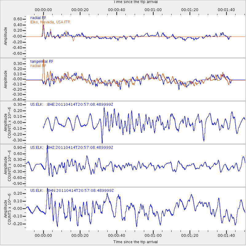
ELK Elko, Nevada, USA - Earthquake Result Viewer
*The percent match for this event was below the threshold and hence no stack was calculated.
| Earthquake location: |
Near Coast Of Nicaragua |
| Earthquake latitude/longitude: |
11.2/-86.4 |
| Earthquake time(UTC): |
2011/04/14 (104) 20:50:16 GMT |
| Earthquake Depth: |
35 km |
| Earthquake Magnitude: |
5.6 MB, 5.4 MS, 5.7 MW, 5.6 MW |
| Earthquake Catalog/Contributor: |
WHDF/NEIC |
|
| Network: |
US United States National Seismic Network |
| Station: |
ELK Elko, Nevada, USA |
| Lat/Lon: |
40.74 N/115.24 W |
| Elevation: |
2210 m |
|
| Distance: |
38.9 deg |
| Az: |
324.255 deg |
| Baz: |
131.02 deg |
| Ray Param: |
$rayparam |
*The percent match for this event was below the threshold and hence was not used in the summary stack. |
|
| Radial Match: |
68.12282 % |
| Radial Bump: |
400 |
| Transverse Match: |
65.86125 % |
| Transverse Bump: |
400 |
| SOD ConfigId: |
356183 |
| Insert Time: |
2011-09-27 17:24:36.597 +0000 |
| GWidth: |
2.5 |
| Max Bumps: |
400 |
| Tol: |
0.001 |
|
Signal To Noise
| Channel | StoN | STA | LTA |
| US:ELK: :BHZ:20110414T20:57:08.489999Z | 3.346243 | 3.5242272E-7 | 1.0531893E-7 |
| US:ELK: :BHN:20110414T20:57:08.489999Z | 1.9373921 | 1.1640202E-7 | 6.008181E-8 |
| US:ELK: :BHE:20110414T20:57:08.489999Z | 2.036161 | 1.3296712E-7 | 6.530286E-8 |
| Arrivals |
| Ps | |
| PpPs | |
| PsPs/PpSs | |


