You are here: Home > Network List > AZ - ANZA Regional Network Stations List
> Station SMER AZ.SMER > Earthquake Result Viewer
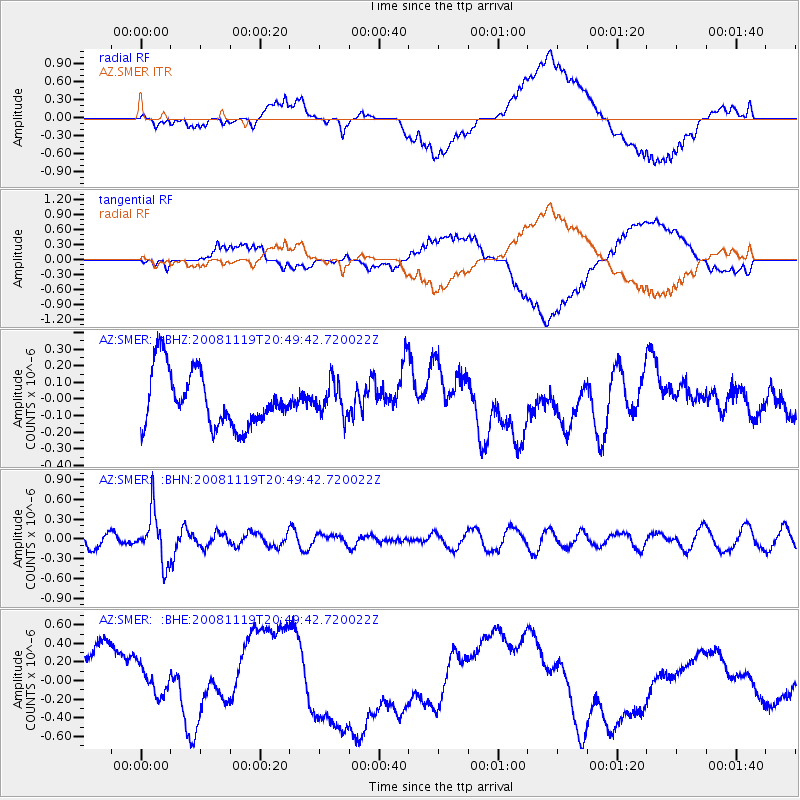
SMER AZ.SMER - Earthquake Result Viewer
*The percent match for this event was below the threshold and hence no stack was calculated.
| Earthquake location: |
South Of Fiji Islands |
| Earthquake latitude/longitude: |
-22.2/-179.7 |
| Earthquake time(UTC): |
2008/11/19 (324) 20:38:58 GMT |
| Earthquake Depth: |
596 km |
| Earthquake Magnitude: |
5.8 MW, 5.2 MB, 5.8 MW |
| Earthquake Catalog/Contributor: |
WHDF/NEIC |
|
| Network: |
AZ ANZA Regional Network |
| Station: |
SMER AZ.SMER |
| Lat/Lon: |
33.46 N/117.17 W |
| Elevation: |
355 m |
|
| Distance: |
81.3 deg |
| Az: |
48.633 deg |
| Baz: |
236.322 deg |
| Ray Param: |
$rayparam |
*The percent match for this event was below the threshold and hence was not used in the summary stack. |
|
| Radial Match: |
62.57651 % |
| Radial Bump: |
400 |
| Transverse Match: |
69.14307 % |
| Transverse Bump: |
400 |
| SOD ConfigId: |
2658 |
| Insert Time: |
2010-02-26 20:48:28.685 +0000 |
| GWidth: |
2.5 |
| Max Bumps: |
400 |
| Tol: |
0.001 |
|
Signal To Noise
| Channel | StoN | STA | LTA |
| AZ:SMER: :BHN:20081119T20:49:42.720022Z | 3.0730813 | 3.7915044E-7 | 1.2337793E-7 |
| AZ:SMER: :BHE:20081119T20:49:42.720022Z | 0.5061141 | 1.4929455E-7 | 2.9498196E-7 |
| AZ:SMER: :BHZ:20081119T20:49:42.720022Z | 0.6010191 | 9.9145986E-8 | 1.6496311E-7 |
| Arrivals |
| Ps | |
| PpPs | |
| PsPs/PpSs | |


