You are here: Home > Network List > AZ - ANZA Regional Network Stations List
> Station SMER AZ.SMER > Earthquake Result Viewer
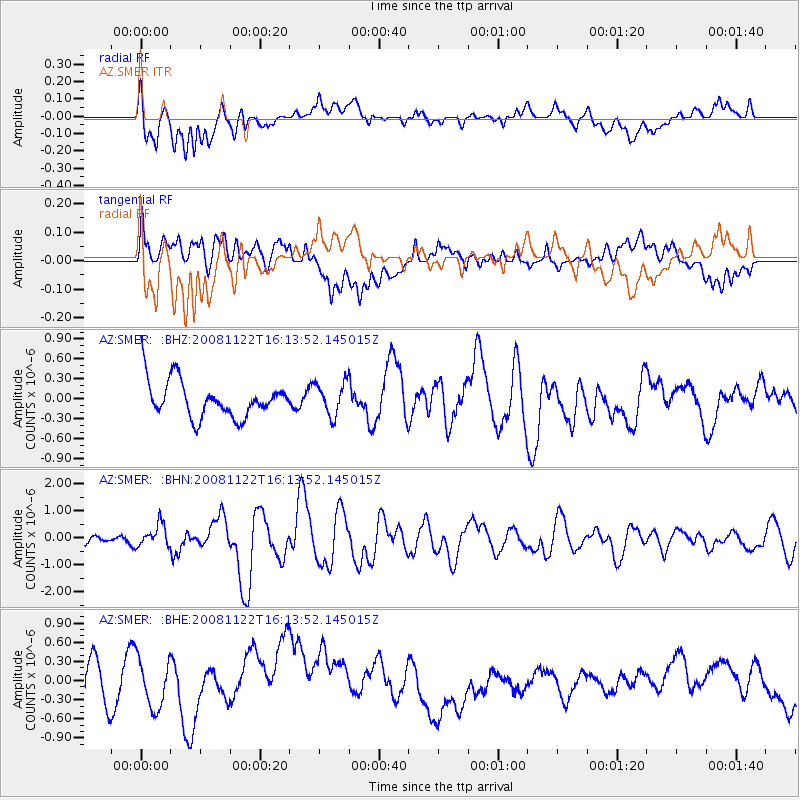
SMER AZ.SMER - Earthquake Result Viewer
*The percent match for this event was below the threshold and hence no stack was calculated.
| Earthquake location: |
Southeast Of Loyalty Islands |
| Earthquake latitude/longitude: |
-22.5/171.2 |
| Earthquake time(UTC): |
2008/11/22 (327) 16:01:39 GMT |
| Earthquake Depth: |
57 km |
| Earthquake Magnitude: |
5.7 MB, 6.4 MW, 6.4 MW |
| Earthquake Catalog/Contributor: |
WHDF/NEIC |
|
| Network: |
AZ ANZA Regional Network |
| Station: |
SMER AZ.SMER |
| Lat/Lon: |
33.46 N/117.17 W |
| Elevation: |
355 m |
|
| Distance: |
88.0 deg |
| Az: |
52.548 deg |
| Baz: |
241.407 deg |
| Ray Param: |
$rayparam |
*The percent match for this event was below the threshold and hence was not used in the summary stack. |
|
| Radial Match: |
53.912533 % |
| Radial Bump: |
400 |
| Transverse Match: |
26.229855 % |
| Transverse Bump: |
400 |
| SOD ConfigId: |
2658 |
| Insert Time: |
2010-02-26 20:48:33.420 +0000 |
| GWidth: |
2.5 |
| Max Bumps: |
400 |
| Tol: |
0.001 |
|
Signal To Noise
| Channel | StoN | STA | LTA |
| AZ:SMER: :BHN:20081122T16:13:52.145015Z | 1.9978194 | 4.1298506E-7 | 2.0671791E-7 |
| AZ:SMER: :BHE:20081122T16:13:52.145015Z | 1.2514539 | 4.462448E-7 | 3.5658113E-7 |
| AZ:SMER: :BHZ:20081122T16:13:52.145015Z | 0.89741784 | 2.4626414E-7 | 2.7441413E-7 |
| Arrivals |
| Ps | |
| PpPs | |
| PsPs/PpSs | |


