You are here: Home > Network List > G - GEOSCOPE Stations List
> Station PPTF Pamatai - Papeete - Tahiti island - French Polynesia, France > Earthquake Result Viewer
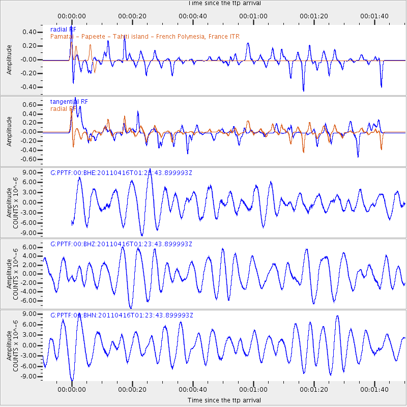
PPTF Pamatai - Papeete - Tahiti island - French Polynesia, France - Earthquake Result Viewer
*The percent match for this event was below the threshold and hence no stack was calculated.
| Earthquake location: |
Northeast Of Taiwan |
| Earthquake latitude/longitude: |
25.4/123.9 |
| Earthquake time(UTC): |
2011/04/16 (106) 01:11:10 GMT |
| Earthquake Depth: |
134 km |
| Earthquake Magnitude: |
5.9 MB, 5.8 MW, 5.8 MW |
| Earthquake Catalog/Contributor: |
WHDF/NEIC |
|
| Network: |
G GEOSCOPE |
| Station: |
PPTF Pamatai - Papeete - Tahiti island - French Polynesia, France |
| Lat/Lon: |
17.59 S/149.57 W |
| Elevation: |
705 m |
|
| Distance: |
94.4 deg |
| Az: |
107.279 deg |
| Baz: |
295.141 deg |
| Ray Param: |
$rayparam |
*The percent match for this event was below the threshold and hence was not used in the summary stack. |
|
| Radial Match: |
44.524433 % |
| Radial Bump: |
400 |
| Transverse Match: |
69.46387 % |
| Transverse Bump: |
400 |
| SOD ConfigId: |
356183 |
| Insert Time: |
2011-09-30 03:27:00.814 +0000 |
| GWidth: |
2.5 |
| Max Bumps: |
400 |
| Tol: |
0.001 |
|
Signal To Noise
| Channel | StoN | STA | LTA |
| G:PPTF:00:BHZ:20110416T01:23:43.899993Z | 0.4885638 | 1.3299274E-6 | 2.7221163E-6 |
| G:PPTF:00:BHN:20110416T01:23:43.899993Z | 1.9969271 | 6.627851E-6 | 3.319025E-6 |
| G:PPTF:00:BHE:20110416T01:23:43.899993Z | 0.65660626 | 2.8345728E-6 | 4.3170053E-6 |
| Arrivals |
| Ps | |
| PpPs | |
| PsPs/PpSs | |


