You are here: Home > Network List > AZ - ANZA Regional Network Stations List
> Station SMER AZ.SMER > Earthquake Result Viewer
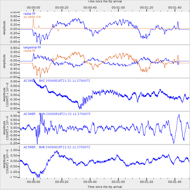
SMER AZ.SMER - Earthquake Result Viewer
*The percent match for this event was below the threshold and hence no stack was calculated.
| Earthquake location: |
South Of Fiji Islands |
| Earthquake latitude/longitude: |
-26.1/-178.4 |
| Earthquake time(UTC): |
2009/08/18 (230) 21:20:47 GMT |
| Earthquake Depth: |
270 km |
| Earthquake Magnitude: |
5.5 MB, 6.3 MW, 6.3 MW |
| Earthquake Catalog/Contributor: |
WHDF/NEIC |
|
| Network: |
AZ ANZA Regional Network |
| Station: |
SMER AZ.SMER |
| Lat/Lon: |
33.46 N/117.17 W |
| Elevation: |
355 m |
|
| Distance: |
83.0 deg |
| Az: |
47.583 deg |
| Baz: |
232.59 deg |
| Ray Param: |
$rayparam |
*The percent match for this event was below the threshold and hence was not used in the summary stack. |
|
| Radial Match: |
43.366634 % |
| Radial Bump: |
400 |
| Transverse Match: |
40.526917 % |
| Transverse Bump: |
400 |
| SOD ConfigId: |
2622 |
| Insert Time: |
2010-02-26 20:48:45.748 +0000 |
| GWidth: |
2.5 |
| Max Bumps: |
400 |
| Tol: |
0.001 |
|
Signal To Noise
| Channel | StoN | STA | LTA |
| AZ:SMER: :BHN:20090818T21:32:11.370007Z | 2.9609113 | 4.088414E-7 | 1.3807959E-7 |
| AZ:SMER: :BHE:20090818T21:32:11.370007Z | 2.9419436 | 1.8401162E-6 | 6.254764E-7 |
| AZ:SMER: :BHZ:20090818T21:32:11.370007Z | 2.815706 | 9.2080177E-7 | 3.270234E-7 |
| Arrivals |
| Ps | |
| PpPs | |
| PsPs/PpSs | |


