You are here: Home > Network List > TA - USArray Transportable Network (new EarthScope stations) Stations List
> Station O03D Paynes Creek, CA, USA > Earthquake Result Viewer
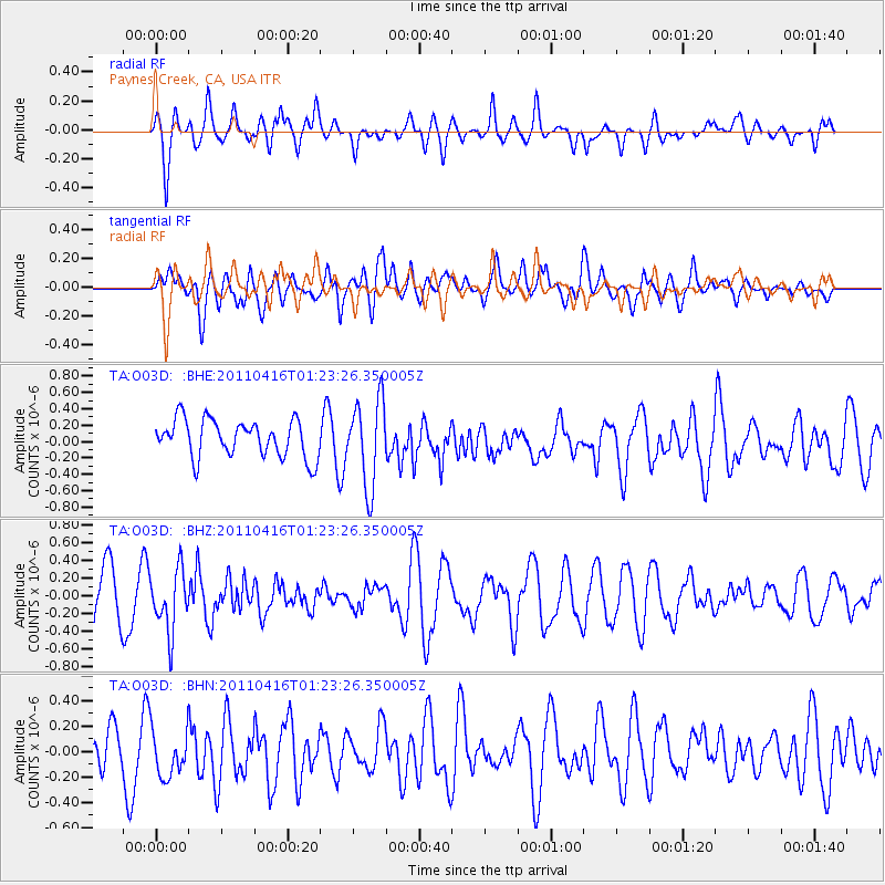
O03D Paynes Creek, CA, USA - Earthquake Result Viewer
*The percent match for this event was below the threshold and hence no stack was calculated.
| Earthquake location: |
Northeast Of Taiwan |
| Earthquake latitude/longitude: |
25.4/123.9 |
| Earthquake time(UTC): |
2011/04/16 (106) 01:11:10 GMT |
| Earthquake Depth: |
134 km |
| Earthquake Magnitude: |
5.9 MB, 5.8 MW, 5.8 MW |
| Earthquake Catalog/Contributor: |
WHDF/NEIC |
|
| Network: |
TA USArray Transportable Network (new EarthScope stations) |
| Station: |
O03D Paynes Creek, CA, USA |
| Lat/Lon: |
40.29 N/121.80 W |
| Elevation: |
968 m |
|
| Distance: |
90.6 deg |
| Az: |
44.195 deg |
| Baz: |
304.497 deg |
| Ray Param: |
$rayparam |
*The percent match for this event was below the threshold and hence was not used in the summary stack. |
|
| Radial Match: |
53.851864 % |
| Radial Bump: |
364 |
| Transverse Match: |
53.31241 % |
| Transverse Bump: |
400 |
| SOD ConfigId: |
356183 |
| Insert Time: |
2011-09-30 03:45:14.626 +0000 |
| GWidth: |
2.5 |
| Max Bumps: |
400 |
| Tol: |
0.001 |
|
Signal To Noise
| Channel | StoN | STA | LTA |
| TA:O03D: :BHZ:20110416T01:23:26.350005Z | 1.5480171 | 3.4724644E-7 | 2.2431692E-7 |
| TA:O03D: :BHN:20110416T01:23:26.350005Z | 0.98670393 | 1.9625415E-7 | 1.9889872E-7 |
| TA:O03D: :BHE:20110416T01:23:26.350005Z | 2.31439 | 5.2778114E-7 | 2.280433E-7 |
| Arrivals |
| Ps | |
| PpPs | |
| PsPs/PpSs | |


