You are here: Home > Network List > US - United States National Seismic Network Stations List
> Station DGMT Dagmar, Montana, USA > Earthquake Result Viewer
DGMT Dagmar, Montana, USA - Earthquake Result Viewer
*The percent match for this event was below the threshold and hence no stack was calculated.
| Earthquake location: |
Northeast Of Taiwan |
| Earthquake latitude/longitude: |
25.4/123.9 |
| Earthquake time(UTC): |
2011/04/16 (106) 01:11:10 GMT |
| Earthquake Depth: |
134 km |
| Earthquake Magnitude: |
5.9 MB, 5.8 MW, 5.8 MW |
| Earthquake Catalog/Contributor: |
WHDF/NEIC |
|
| Network: |
US United States National Seismic Network |
| Station: |
DGMT Dagmar, Montana, USA |
| Lat/Lon: |
48.47 N/104.20 W |
| Elevation: |
0.0 m |
|
| Distance: |
94.8 deg |
| Az: |
29.8 deg |
| Baz: |
317.524 deg |
| Ray Param: |
$rayparam |
*The percent match for this event was below the threshold and hence was not used in the summary stack. |
|
| Radial Match: |
47.61713 % |
| Radial Bump: |
292 |
| Transverse Match: |
59.39614 % |
| Transverse Bump: |
361 |
| SOD ConfigId: |
356183 |
| Insert Time: |
2011-09-30 03:49:39.541 +0000 |
| GWidth: |
2.5 |
| Max Bumps: |
400 |
| Tol: |
0.001 |
|
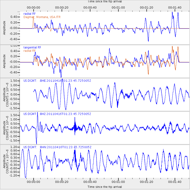
Signal To Noise
| Channel | StoN | STA | LTA |
| US:DGMT: :BHZ:20110416T01:23:45.725005Z | 4.8522563 | 7.416481E-7 | 1.5284603E-7 |
| US:DGMT: :BHN:20110416T01:23:45.725005Z | 0.9501036 | 4.6400476E-7 | 4.8837285E-7 |
| US:DGMT: :BHE:20110416T01:23:45.725005Z | 0.49426875 | 3.8104406E-7 | 7.709249E-7 |
| Arrivals |
| Ps | |
| PpPs | |
| PsPs/PpSs | |


