You are here: Home > Network List > US - United States National Seismic Network Stations List
> Station EGMT Eagleton, Montana, USA > Earthquake Result Viewer
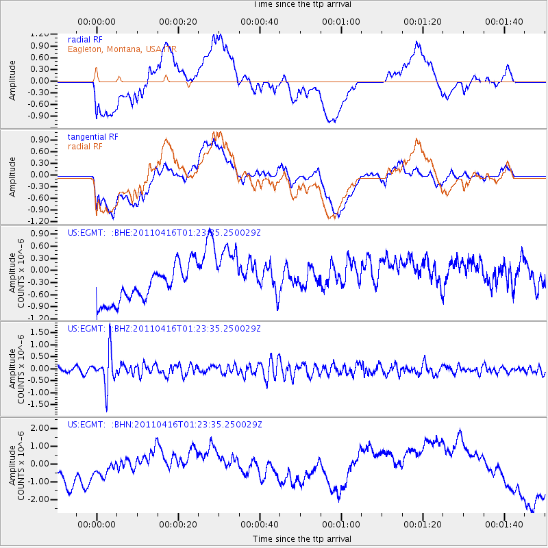
EGMT Eagleton, Montana, USA - Earthquake Result Viewer
*The percent match for this event was below the threshold and hence no stack was calculated.
| Earthquake location: |
Northeast Of Taiwan |
| Earthquake latitude/longitude: |
25.4/123.9 |
| Earthquake time(UTC): |
2011/04/16 (106) 01:11:10 GMT |
| Earthquake Depth: |
134 km |
| Earthquake Magnitude: |
5.9 MB, 5.8 MW, 5.8 MW |
| Earthquake Catalog/Contributor: |
WHDF/NEIC |
|
| Network: |
US United States National Seismic Network |
| Station: |
EGMT Eagleton, Montana, USA |
| Lat/Lon: |
48.02 N/109.75 W |
| Elevation: |
1055 m |
|
| Distance: |
92.5 deg |
| Az: |
32.763 deg |
| Baz: |
313.2 deg |
| Ray Param: |
$rayparam |
*The percent match for this event was below the threshold and hence was not used in the summary stack. |
|
| Radial Match: |
23.36675 % |
| Radial Bump: |
400 |
| Transverse Match: |
22.91287 % |
| Transverse Bump: |
400 |
| SOD ConfigId: |
356183 |
| Insert Time: |
2011-09-30 03:50:42.317 +0000 |
| GWidth: |
2.5 |
| Max Bumps: |
400 |
| Tol: |
0.001 |
|
Signal To Noise
| Channel | StoN | STA | LTA |
| US:EGMT: :BHZ:20110416T01:23:35.250029Z | 4.2370286 | 7.296065E-7 | 1.7219769E-7 |
| US:EGMT: :BHN:20110416T01:23:35.250029Z | 0.66294086 | 5.1022516E-7 | 7.69639E-7 |
| US:EGMT: :BHE:20110416T01:23:35.250029Z | 1.8341514 | 7.8812565E-7 | 4.2969498E-7 |
| Arrivals |
| Ps | |
| PpPs | |
| PsPs/PpSs | |


