You are here: Home > Network List > UW - Pacific Northwest Regional Seismic Network Stations List
> Station GNW Green Mountain (BB) > Earthquake Result Viewer
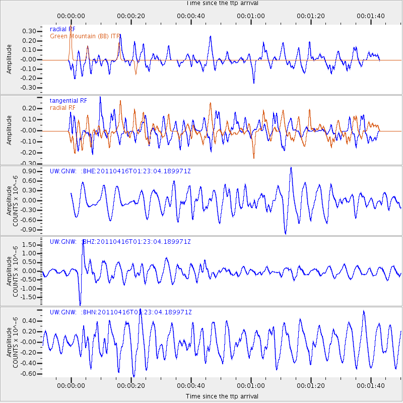
GNW Green Mountain (BB) - Earthquake Result Viewer
*The percent match for this event was below the threshold and hence no stack was calculated.
| Earthquake location: |
Northeast Of Taiwan |
| Earthquake latitude/longitude: |
25.4/123.9 |
| Earthquake time(UTC): |
2011/04/16 (106) 01:11:10 GMT |
| Earthquake Depth: |
134 km |
| Earthquake Magnitude: |
5.9 MB, 5.8 MW, 5.8 MW |
| Earthquake Catalog/Contributor: |
WHDF/NEIC |
|
| Network: |
UW Pacific Northwest Regional Seismic Network |
| Station: |
GNW Green Mountain (BB) |
| Lat/Lon: |
47.56 N/122.83 W |
| Elevation: |
160 m |
|
| Distance: |
85.9 deg |
| Az: |
38.587 deg |
| Baz: |
303.612 deg |
| Ray Param: |
$rayparam |
*The percent match for this event was below the threshold and hence was not used in the summary stack. |
|
| Radial Match: |
55.960117 % |
| Radial Bump: |
356 |
| Transverse Match: |
70.37096 % |
| Transverse Bump: |
400 |
| SOD ConfigId: |
356183 |
| Insert Time: |
2011-09-30 03:51:26.971 +0000 |
| GWidth: |
2.5 |
| Max Bumps: |
400 |
| Tol: |
0.001 |
|
Signal To Noise
| Channel | StoN | STA | LTA |
| UW:GNW: :BHZ:20110416T01:23:04.189971Z | 6.4054456 | 8.081432E-7 | 1.2616502E-7 |
| UW:GNW: :BHN:20110416T01:23:04.189971Z | 0.8031751 | 1.3294053E-7 | 1.6551874E-7 |
| UW:GNW: :BHE:20110416T01:23:04.189971Z | 1.1059412 | 2.9429387E-7 | 2.6610266E-7 |
| Arrivals |
| Ps | |
| PpPs | |
| PsPs/PpSs | |


