You are here: Home > Network List > AZ - ANZA Regional Network Stations List
> Station SMER AZ.SMER > Earthquake Result Viewer
SMER AZ.SMER - Earthquake Result Viewer
*The percent match for this event was below the threshold and hence no stack was calculated.
| Earthquake location: |
Eastern Honshu, Japan |
| Earthquake latitude/longitude: |
36.4/139.7 |
| Earthquake time(UTC): |
2011/04/16 (106) 02:19:30 GMT |
| Earthquake Depth: |
77 km |
| Earthquake Magnitude: |
5.9 MB, 5.8 MW, 5.8 MW |
| Earthquake Catalog/Contributor: |
WHDF/NEIC |
|
| Network: |
AZ ANZA Regional Network |
| Station: |
SMER AZ.SMER |
| Lat/Lon: |
33.46 N/117.17 W |
| Elevation: |
355 m |
|
| Distance: |
80.2 deg |
| Az: |
55.694 deg |
| Baz: |
307.116 deg |
| Ray Param: |
$rayparam |
*The percent match for this event was below the threshold and hence was not used in the summary stack. |
|
| Radial Match: |
51.201584 % |
| Radial Bump: |
400 |
| Transverse Match: |
57.623947 % |
| Transverse Bump: |
400 |
| SOD ConfigId: |
356183 |
| Insert Time: |
2011-09-30 04:05:10.799 +0000 |
| GWidth: |
2.5 |
| Max Bumps: |
400 |
| Tol: |
0.001 |
|
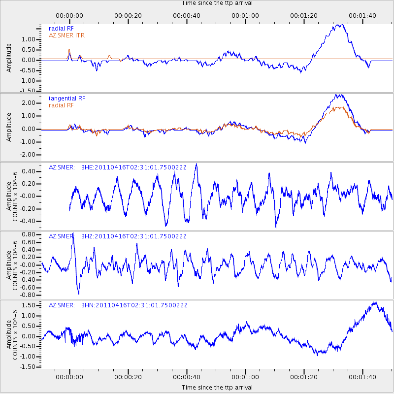
Signal To Noise
| Channel | StoN | STA | LTA |
| AZ:SMER: :BHZ:20110416T02:31:01.750022Z | 2.613255 | 4.1614373E-7 | 1.5924344E-7 |
| AZ:SMER: :BHN:20110416T02:31:01.750022Z | 1.5202246 | 2.4701598E-7 | 1.6248651E-7 |
| AZ:SMER: :BHE:20110416T02:31:01.750022Z | 1.8079375 | 2.6240372E-7 | 1.4513981E-7 |
| Arrivals |
| Ps | |
| PpPs | |
| PsPs/PpSs | |


