You are here: Home > Network List > CI - Caltech Regional Seismic Network Stations List
> Station BAR Barrett, Tecate, CA, USA > Earthquake Result Viewer
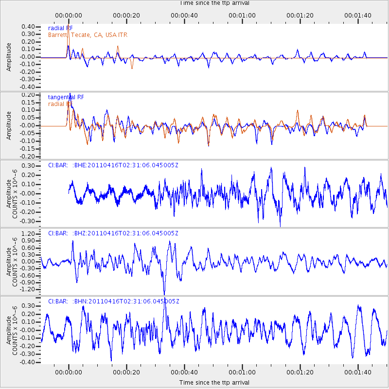
BAR Barrett, Tecate, CA, USA - Earthquake Result Viewer
*The percent match for this event was below the threshold and hence no stack was calculated.
| Earthquake location: |
Eastern Honshu, Japan |
| Earthquake latitude/longitude: |
36.4/139.7 |
| Earthquake time(UTC): |
2011/04/16 (106) 02:19:30 GMT |
| Earthquake Depth: |
77 km |
| Earthquake Magnitude: |
5.9 MB, 5.8 MW, 5.8 MW |
| Earthquake Catalog/Contributor: |
WHDF/NEIC |
|
| Network: |
CI Caltech Regional Seismic Network |
| Station: |
BAR Barrett, Tecate, CA, USA |
| Lat/Lon: |
32.68 N/116.67 W |
| Elevation: |
521 m |
|
| Distance: |
81.0 deg |
| Az: |
56.063 deg |
| Baz: |
307.447 deg |
| Ray Param: |
$rayparam |
*The percent match for this event was below the threshold and hence was not used in the summary stack. |
|
| Radial Match: |
50.743076 % |
| Radial Bump: |
400 |
| Transverse Match: |
74.07197 % |
| Transverse Bump: |
400 |
| SOD ConfigId: |
356183 |
| Insert Time: |
2011-09-30 04:06:24.350 +0000 |
| GWidth: |
2.5 |
| Max Bumps: |
400 |
| Tol: |
0.001 |
|
Signal To Noise
| Channel | StoN | STA | LTA |
| CI:BAR: :BHZ:20110416T02:31:06.045005Z | 2.4171402 | 3.8473664E-7 | 1.5917017E-7 |
| CI:BAR: :BHN:20110416T02:31:06.045005Z | 1.4026674 | 1.665611E-7 | 1.18745966E-7 |
| CI:BAR: :BHE:20110416T02:31:06.045005Z | 1.3587762 | 7.485169E-8 | 5.5087582E-8 |
| Arrivals |
| Ps | |
| PpPs | |
| PsPs/PpSs | |


