You are here: Home > Network List > AZ - ANZA Regional Network Stations List
> Station SMER AZ.SMER > Earthquake Result Viewer
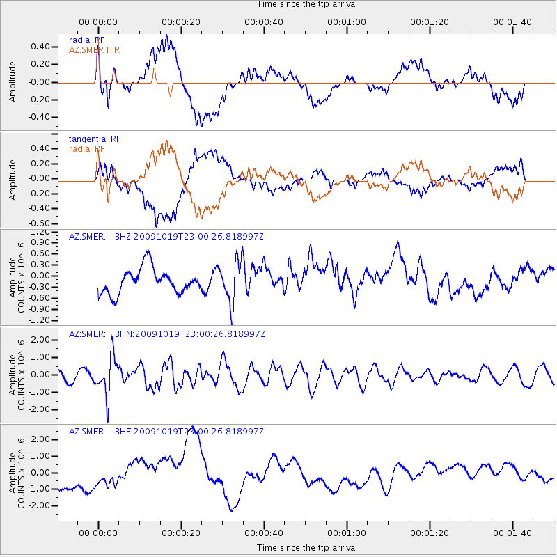
SMER AZ.SMER - Earthquake Result Viewer
*The percent match for this event was below the threshold and hence no stack was calculated.
| Earthquake location: |
Samoa Islands Region |
| Earthquake latitude/longitude: |
-15.4/-172.3 |
| Earthquake time(UTC): |
2009/10/19 (292) 22:49:38 GMT |
| Earthquake Depth: |
18 km |
| Earthquake Magnitude: |
6.2 MB, 5.7 MS, 6.0 MW, 5.9 MW |
| Earthquake Catalog/Contributor: |
WHDF/NEIC |
|
| Network: |
AZ ANZA Regional Network |
| Station: |
SMER AZ.SMER |
| Lat/Lon: |
33.46 N/117.17 W |
| Elevation: |
355 m |
|
| Distance: |
71.5 deg |
| Az: |
46.293 deg |
| Baz: |
236.533 deg |
| Ray Param: |
$rayparam |
*The percent match for this event was below the threshold and hence was not used in the summary stack. |
|
| Radial Match: |
45.563705 % |
| Radial Bump: |
400 |
| Transverse Match: |
50.186623 % |
| Transverse Bump: |
400 |
| SOD ConfigId: |
2622 |
| Insert Time: |
2010-02-26 20:48:57.236 +0000 |
| GWidth: |
2.5 |
| Max Bumps: |
400 |
| Tol: |
0.001 |
|
Signal To Noise
| Channel | StoN | STA | LTA |
| AZ:SMER: :BHN:20091019T23:00:26.818997Z | 5.4117084 | 1.1346216E-6 | 2.0966053E-7 |
| AZ:SMER: :BHE:20091019T23:00:26.818997Z | 0.28955495 | 2.7260896E-7 | 9.4147566E-7 |
| AZ:SMER: :BHZ:20091019T23:00:26.818997Z | 1.719415 | 5.7554206E-7 | 3.347313E-7 |
| Arrivals |
| Ps | |
| PpPs | |
| PsPs/PpSs | |


