You are here: Home > Network List > CI - Caltech Regional Seismic Network Stations List
> Station MPM Manuel Prospect Mine, California, USA > Earthquake Result Viewer
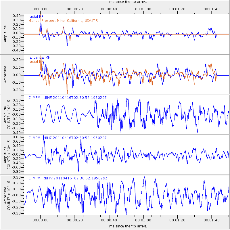
MPM Manuel Prospect Mine, California, USA - Earthquake Result Viewer
*The percent match for this event was below the threshold and hence no stack was calculated.
| Earthquake location: |
Eastern Honshu, Japan |
| Earthquake latitude/longitude: |
36.4/139.7 |
| Earthquake time(UTC): |
2011/04/16 (106) 02:19:30 GMT |
| Earthquake Depth: |
77 km |
| Earthquake Magnitude: |
5.9 MB, 5.8 MW, 5.8 MW |
| Earthquake Catalog/Contributor: |
WHDF/NEIC |
|
| Network: |
CI Caltech Regional Seismic Network |
| Station: |
MPM Manuel Prospect Mine, California, USA |
| Lat/Lon: |
36.06 N/117.49 W |
| Elevation: |
185 m |
|
| Distance: |
78.4 deg |
| Az: |
53.742 deg |
| Baz: |
306.573 deg |
| Ray Param: |
$rayparam |
*The percent match for this event was below the threshold and hence was not used in the summary stack. |
|
| Radial Match: |
66.90824 % |
| Radial Bump: |
400 |
| Transverse Match: |
69.58209 % |
| Transverse Bump: |
400 |
| SOD ConfigId: |
356183 |
| Insert Time: |
2011-09-30 04:10:23.866 +0000 |
| GWidth: |
2.5 |
| Max Bumps: |
400 |
| Tol: |
0.001 |
|
Signal To Noise
| Channel | StoN | STA | LTA |
| CI:MPM: :BHZ:20110416T02:30:52.195029Z | 2.2901719 | 3.5157652E-7 | 1.5351534E-7 |
| CI:MPM: :BHN:20110416T02:30:52.195029Z | 0.9561064 | 1.0164152E-7 | 1.06307745E-7 |
| CI:MPM: :BHE:20110416T02:30:52.195029Z | 1.4382704 | 1.7079283E-7 | 1.18748765E-7 |
| Arrivals |
| Ps | |
| PpPs | |
| PsPs/PpSs | |


