You are here: Home > Network List > CI - Caltech Regional Seismic Network Stations List
> Station MPP McPhearson Peak > Earthquake Result Viewer
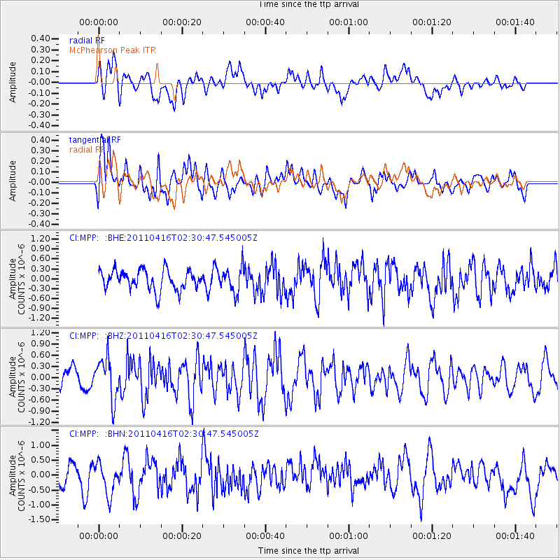
MPP McPhearson Peak - Earthquake Result Viewer
*The percent match for this event was below the threshold and hence no stack was calculated.
| Earthquake location: |
Eastern Honshu, Japan |
| Earthquake latitude/longitude: |
36.4/139.7 |
| Earthquake time(UTC): |
2011/04/16 (106) 02:19:30 GMT |
| Earthquake Depth: |
77 km |
| Earthquake Magnitude: |
5.9 MB, 5.8 MW, 5.8 MW |
| Earthquake Catalog/Contributor: |
WHDF/NEIC |
|
| Network: |
CI Caltech Regional Seismic Network |
| Station: |
MPP McPhearson Peak |
| Lat/Lon: |
34.89 N/119.81 W |
| Elevation: |
1739 m |
|
| Distance: |
77.6 deg |
| Az: |
55.849 deg |
| Baz: |
305.668 deg |
| Ray Param: |
$rayparam |
*The percent match for this event was below the threshold and hence was not used in the summary stack. |
|
| Radial Match: |
51.642616 % |
| Radial Bump: |
400 |
| Transverse Match: |
52.92325 % |
| Transverse Bump: |
400 |
| SOD ConfigId: |
356183 |
| Insert Time: |
2011-09-30 04:11:25.382 +0000 |
| GWidth: |
2.5 |
| Max Bumps: |
400 |
| Tol: |
0.001 |
|
Signal To Noise
| Channel | StoN | STA | LTA |
| CI:MPP: :BHZ:20110416T02:30:47.545005Z | 2.186287 | 5.64835E-7 | 2.5835354E-7 |
| CI:MPP: :BHN:20110416T02:30:47.545005Z | 1.0436203 | 5.701777E-7 | 5.463459E-7 |
| CI:MPP: :BHE:20110416T02:30:47.545005Z | 1.2399179 | 3.7340448E-7 | 3.0115257E-7 |
| Arrivals |
| Ps | |
| PpPs | |
| PsPs/PpSs | |


