You are here: Home > Network List > AZ - ANZA Regional Network Stations List
> Station SMER AZ.SMER > Earthquake Result Viewer
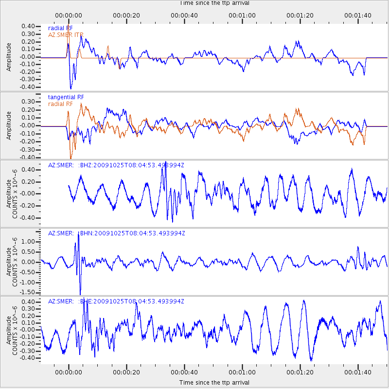
SMER AZ.SMER - Earthquake Result Viewer
*The percent match for this event was below the threshold and hence no stack was calculated.
| Earthquake location: |
South Of Fiji Islands |
| Earthquake latitude/longitude: |
-23.1/-179.2 |
| Earthquake time(UTC): |
2009/10/25 (298) 07:53:52 GMT |
| Earthquake Depth: |
418 km |
| Earthquake Magnitude: |
5.6 MB, 6.0 MW, 5.9 MW |
| Earthquake Catalog/Contributor: |
WHDF/NEIC |
|
| Network: |
AZ ANZA Regional Network |
| Station: |
SMER AZ.SMER |
| Lat/Lon: |
33.46 N/117.17 W |
| Elevation: |
355 m |
|
| Distance: |
81.5 deg |
| Az: |
48.286 deg |
| Baz: |
235.309 deg |
| Ray Param: |
$rayparam |
*The percent match for this event was below the threshold and hence was not used in the summary stack. |
|
| Radial Match: |
65.039604 % |
| Radial Bump: |
400 |
| Transverse Match: |
53.64883 % |
| Transverse Bump: |
400 |
| SOD ConfigId: |
2622 |
| Insert Time: |
2010-02-26 20:48:57.961 +0000 |
| GWidth: |
2.5 |
| Max Bumps: |
400 |
| Tol: |
0.001 |
|
Signal To Noise
| Channel | StoN | STA | LTA |
| AZ:SMER: :BHN:20091025T08:04:53.493994Z | 3.5371306 | 6.044597E-7 | 1.7088985E-7 |
| AZ:SMER: :BHE:20091025T08:04:53.493994Z | 1.2209638 | 1.9983646E-7 | 1.6367107E-7 |
| AZ:SMER: :BHZ:20091025T08:04:53.493994Z | 2.1230361 | 2.8548993E-7 | 1.3447247E-7 |
| Arrivals |
| Ps | |
| PpPs | |
| PsPs/PpSs | |


