You are here: Home > Network List > AZ - ANZA Regional Network Stations List
> Station SMER AZ.SMER > Earthquake Result Viewer
SMER AZ.SMER - Earthquake Result Viewer
*The percent match for this event was below the threshold and hence no stack was calculated.
| Earthquake location: |
Santa Cruz Islands |
| Earthquake latitude/longitude: |
-11.4/166.4 |
| Earthquake time(UTC): |
2009/10/31 (304) 19:09:51 GMT |
| Earthquake Depth: |
134 km |
| Earthquake Magnitude: |
5.9 MB, 5.9 MW, 5.9 MW |
| Earthquake Catalog/Contributor: |
WHDF/NEIC |
|
| Network: |
AZ ANZA Regional Network |
| Station: |
SMER AZ.SMER |
| Lat/Lon: |
33.46 N/117.17 W |
| Elevation: |
355 m |
|
| Distance: |
85.2 deg |
| Az: |
54.651 deg |
| Baz: |
253.087 deg |
| Ray Param: |
$rayparam |
*The percent match for this event was below the threshold and hence was not used in the summary stack. |
|
| Radial Match: |
66.85582 % |
| Radial Bump: |
400 |
| Transverse Match: |
48.309082 % |
| Transverse Bump: |
400 |
| SOD ConfigId: |
2622 |
| Insert Time: |
2010-02-26 20:49:00.446 +0000 |
| GWidth: |
2.5 |
| Max Bumps: |
400 |
| Tol: |
0.001 |
|
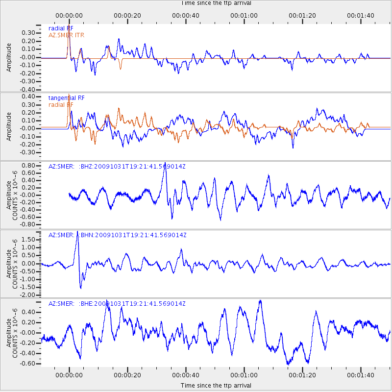
Signal To Noise
| Channel | StoN | STA | LTA |
| AZ:SMER: :BHN:20091031T19:21:41.569014Z | 6.4608536 | 9.050216E-7 | 1.400777E-7 |
| AZ:SMER: :BHE:20091031T19:21:41.569014Z | 1.8903346 | 2.141717E-7 | 1.132983E-7 |
| AZ:SMER: :BHZ:20091031T19:21:41.569014Z | 3.1232994 | 3.834222E-7 | 1.2276192E-7 |
| Arrivals |
| Ps | |
| PpPs | |
| PsPs/PpSs | |


