You are here: Home > Network List > IC - New China Digital Seismograph Network Stations List
> Station LSA Tibet, China > Earthquake Result Viewer
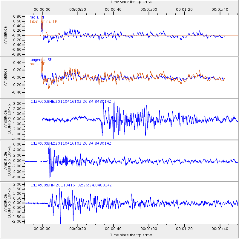
LSA Tibet, China - Earthquake Result Viewer
*The percent match for this event was below the threshold and hence no stack was calculated.
| Earthquake location: |
Eastern Honshu, Japan |
| Earthquake latitude/longitude: |
36.4/139.7 |
| Earthquake time(UTC): |
2011/04/16 (106) 02:19:30 GMT |
| Earthquake Depth: |
77 km |
| Earthquake Magnitude: |
5.9 MB, 5.8 MW, 5.8 MW |
| Earthquake Catalog/Contributor: |
WHDF/NEIC |
|
| Network: |
IC New China Digital Seismograph Network |
| Station: |
LSA Tibet, China |
| Lat/Lon: |
29.70 N/91.13 E |
| Elevation: |
3660 m |
|
| Distance: |
40.9 deg |
| Az: |
275.049 deg |
| Baz: |
67.514 deg |
| Ray Param: |
$rayparam |
*The percent match for this event was below the threshold and hence was not used in the summary stack. |
|
| Radial Match: |
69.115654 % |
| Radial Bump: |
400 |
| Transverse Match: |
73.213554 % |
| Transverse Bump: |
400 |
| SOD ConfigId: |
356183 |
| Insert Time: |
2011-09-30 04:15:44.601 +0000 |
| GWidth: |
2.5 |
| Max Bumps: |
400 |
| Tol: |
0.001 |
|
Signal To Noise
| Channel | StoN | STA | LTA |
| IC:LSA:00:BHZ:20110416T02:26:34.848014Z | 48.81298 | 2.4046271E-6 | 4.926204E-8 |
| IC:LSA:00:BHN:20110416T02:26:34.848014Z | 5.107485 | 1.6156424E-7 | 3.1632837E-8 |
| IC:LSA:00:BHE:20110416T02:26:34.848014Z | 4.4142585 | 1.0994178E-6 | 2.490606E-7 |
| Arrivals |
| Ps | |
| PpPs | |
| PsPs/PpSs | |


