You are here: Home > Network List > IW - Intermountain West Stations List
> Station MOOW Moose Ponds, Wyoming, USA > Earthquake Result Viewer
MOOW Moose Ponds, Wyoming, USA - Earthquake Result Viewer
*The percent match for this event was below the threshold and hence no stack was calculated.
| Earthquake location: |
Eastern Honshu, Japan |
| Earthquake latitude/longitude: |
36.4/139.7 |
| Earthquake time(UTC): |
2011/04/16 (106) 02:19:30 GMT |
| Earthquake Depth: |
77 km |
| Earthquake Magnitude: |
5.9 MB, 5.8 MW, 5.8 MW |
| Earthquake Catalog/Contributor: |
WHDF/NEIC |
|
| Network: |
IW Intermountain West |
| Station: |
MOOW Moose Ponds, Wyoming, USA |
| Lat/Lon: |
43.75 N/110.74 W |
| Elevation: |
2128 m |
|
| Distance: |
77.8 deg |
| Az: |
44.297 deg |
| Baz: |
308.949 deg |
| Ray Param: |
$rayparam |
*The percent match for this event was below the threshold and hence was not used in the summary stack. |
|
| Radial Match: |
70.578835 % |
| Radial Bump: |
400 |
| Transverse Match: |
69.005646 % |
| Transverse Bump: |
400 |
| SOD ConfigId: |
356183 |
| Insert Time: |
2011-09-30 04:19:30.338 +0000 |
| GWidth: |
2.5 |
| Max Bumps: |
400 |
| Tol: |
0.001 |
|
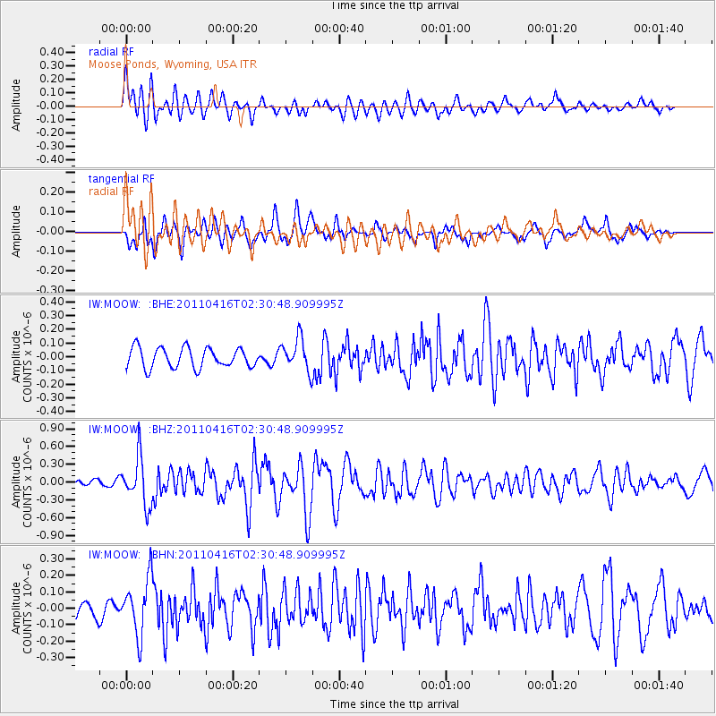
Signal To Noise
| Channel | StoN | STA | LTA |
| IW:MOOW: :BHZ:20110416T02:30:48.909995Z | 4.198161 | 4.067762E-7 | 9.689389E-8 |
| IW:MOOW: :BHN:20110416T02:30:48.909995Z | 1.8505493 | 1.7397544E-7 | 9.4012854E-8 |
| IW:MOOW: :BHE:20110416T02:30:48.909995Z | 1.6619573 | 1.2034754E-7 | 7.241314E-8 |
| Arrivals |
| Ps | |
| PpPs | |
| PsPs/PpSs | |


