You are here: Home > Network List > AZ - ANZA Regional Network Stations List
> Station SMER AZ.SMER > Earthquake Result Viewer
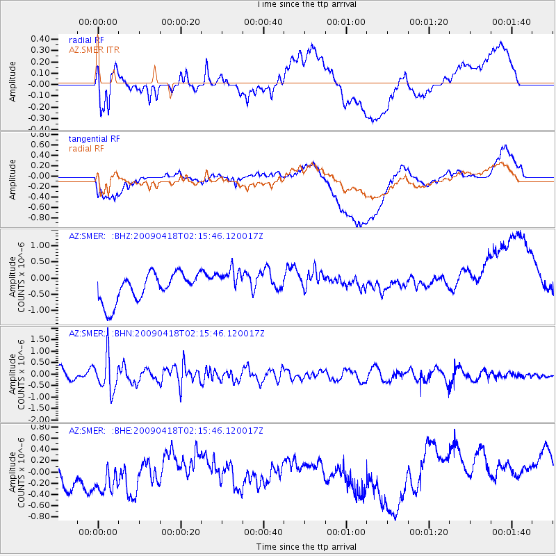
SMER AZ.SMER - Earthquake Result Viewer
*The percent match for this event was below the threshold and hence no stack was calculated.
| Earthquake location: |
Kermadec Islands Region |
| Earthquake latitude/longitude: |
-28.9/-177.4 |
| Earthquake time(UTC): |
2009/04/18 (108) 02:03:52 GMT |
| Earthquake Depth: |
65 km |
| Earthquake Magnitude: |
6.0 MB, 5.8 MW, 5.7 MW |
| Earthquake Catalog/Contributor: |
WHDF/NEIC |
|
| Network: |
AZ ANZA Regional Network |
| Station: |
SMER AZ.SMER |
| Lat/Lon: |
33.46 N/117.17 W |
| Elevation: |
355 m |
|
| Distance: |
84.3 deg |
| Az: |
46.853 deg |
| Baz: |
229.919 deg |
| Ray Param: |
$rayparam |
*The percent match for this event was below the threshold and hence was not used in the summary stack. |
|
| Radial Match: |
52.54421 % |
| Radial Bump: |
400 |
| Transverse Match: |
33.42383 % |
| Transverse Bump: |
400 |
| SOD ConfigId: |
2658 |
| Insert Time: |
2010-02-26 20:49:13.697 +0000 |
| GWidth: |
2.5 |
| Max Bumps: |
400 |
| Tol: |
0.001 |
|
Signal To Noise
| Channel | StoN | STA | LTA |
| AZ:SMER: :BHN:20090418T02:15:46.120017Z | 2.4020853 | 7.731768E-7 | 3.2187734E-7 |
| AZ:SMER: :BHE:20090418T02:15:46.120017Z | 1.1282605 | 5.9197566E-7 | 5.2467993E-7 |
| AZ:SMER: :BHZ:20090418T02:15:46.120017Z | 1.0124792 | 4.3842576E-7 | 4.33022E-7 |
| Arrivals |
| Ps | |
| PpPs | |
| PsPs/PpSs | |


