You are here: Home > Network List > AZ - ANZA Regional Network Stations List
> Station SMER AZ.SMER > Earthquake Result Viewer
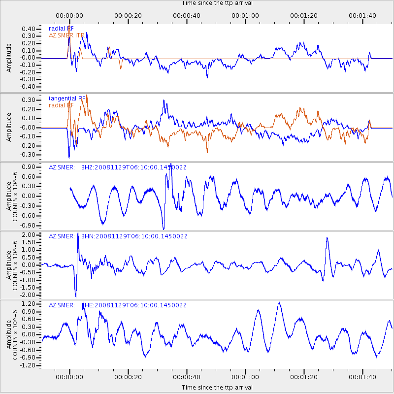
SMER AZ.SMER - Earthquake Result Viewer
*The percent match for this event was below the threshold and hence no stack was calculated.
| Earthquake location: |
Fiji Islands Region |
| Earthquake latitude/longitude: |
-18.7/-177.7 |
| Earthquake time(UTC): |
2008/11/29 (334) 05:59:16 GMT |
| Earthquake Depth: |
386 km |
| Earthquake Magnitude: |
5.7 MB, 6.0 MW, 5.9 MW |
| Earthquake Catalog/Contributor: |
WHDF/NEIC |
|
| Network: |
AZ ANZA Regional Network |
| Station: |
SMER AZ.SMER |
| Lat/Lon: |
33.46 N/117.17 W |
| Elevation: |
355 m |
|
| Distance: |
77.6 deg |
| Az: |
48.187 deg |
| Baz: |
237.678 deg |
| Ray Param: |
$rayparam |
*The percent match for this event was below the threshold and hence was not used in the summary stack. |
|
| Radial Match: |
50.151344 % |
| Radial Bump: |
400 |
| Transverse Match: |
41.308758 % |
| Transverse Bump: |
400 |
| SOD ConfigId: |
2658 |
| Insert Time: |
2010-02-26 20:49:16.336 +0000 |
| GWidth: |
2.5 |
| Max Bumps: |
400 |
| Tol: |
0.001 |
|
Signal To Noise
| Channel | StoN | STA | LTA |
| AZ:SMER: :BHN:20081129T06:10:00.145002Z | 4.469025 | 8.6564785E-7 | 1.9369949E-7 |
| AZ:SMER: :BHE:20081129T06:10:00.145002Z | 3.1757598 | 7.832995E-7 | 2.4664948E-7 |
| AZ:SMER: :BHZ:20081129T06:10:00.145002Z | 1.9244868 | 5.9813965E-7 | 3.1080478E-7 |
| Arrivals |
| Ps | |
| PpPs | |
| PsPs/PpSs | |


