You are here: Home > Network List > AZ - ANZA Regional Network Stations List
> Station SMER AZ.SMER > Earthquake Result Viewer
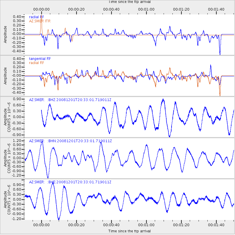
SMER AZ.SMER - Earthquake Result Viewer
*The percent match for this event was below the threshold and hence no stack was calculated.
| Earthquake location: |
Tonga Islands Region |
| Earthquake latitude/longitude: |
-22.9/-175.2 |
| Earthquake time(UTC): |
2008/12/01 (336) 20:21:34 GMT |
| Earthquake Depth: |
39 km |
| Earthquake Magnitude: |
5.5 MB, 5.1 MS |
| Earthquake Catalog/Contributor: |
WHDF/NEIC |
|
| Network: |
AZ ANZA Regional Network |
| Station: |
SMER AZ.SMER |
| Lat/Lon: |
33.46 N/117.17 W |
| Elevation: |
355 m |
|
| Distance: |
78.7 deg |
| Az: |
46.308 deg |
| Baz: |
232.874 deg |
| Ray Param: |
$rayparam |
*The percent match for this event was below the threshold and hence was not used in the summary stack. |
|
| Radial Match: |
72.2823 % |
| Radial Bump: |
400 |
| Transverse Match: |
64.6365 % |
| Transverse Bump: |
400 |
| SOD ConfigId: |
2658 |
| Insert Time: |
2010-02-26 20:49:16.931 +0000 |
| GWidth: |
2.5 |
| Max Bumps: |
400 |
| Tol: |
0.001 |
|
Signal To Noise
| Channel | StoN | STA | LTA |
| AZ:SMER: :BHN:20081201T20:33:01.719011Z | 1.7080206 | 8.7899457E-7 | 5.1462763E-7 |
| AZ:SMER: :BHE:20081201T20:33:01.719011Z | 1.7162827 | 6.2039993E-7 | 3.6147887E-7 |
| AZ:SMER: :BHZ:20081201T20:33:01.719011Z | 1.195661 | 2.541889E-7 | 2.125928E-7 |
| Arrivals |
| Ps | |
| PpPs | |
| PsPs/PpSs | |


