You are here: Home > Network List > TA - USArray Transportable Network (new EarthScope stations) Stations List
> Station 635A Leesville, TX, USA > Earthquake Result Viewer
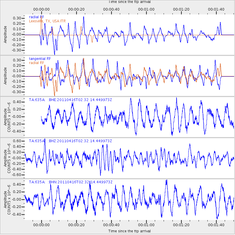
635A Leesville, TX, USA - Earthquake Result Viewer
*The percent match for this event was below the threshold and hence no stack was calculated.
| Earthquake location: |
Eastern Honshu, Japan |
| Earthquake latitude/longitude: |
36.4/139.7 |
| Earthquake time(UTC): |
2011/04/16 (106) 02:19:30 GMT |
| Earthquake Depth: |
77 km |
| Earthquake Magnitude: |
5.9 MB, 5.8 MW, 5.8 MW |
| Earthquake Catalog/Contributor: |
WHDF/NEIC |
|
| Network: |
TA USArray Transportable Network (new EarthScope stations) |
| Station: |
635A Leesville, TX, USA |
| Lat/Lon: |
29.39 N/97.77 W |
| Elevation: |
119 m |
|
| Distance: |
95.2 deg |
| Az: |
47.604 deg |
| Baz: |
316.929 deg |
| Ray Param: |
$rayparam |
*The percent match for this event was below the threshold and hence was not used in the summary stack. |
|
| Radial Match: |
60.051556 % |
| Radial Bump: |
400 |
| Transverse Match: |
52.77672 % |
| Transverse Bump: |
400 |
| SOD ConfigId: |
356183 |
| Insert Time: |
2011-09-30 05:12:04.771 +0000 |
| GWidth: |
2.5 |
| Max Bumps: |
400 |
| Tol: |
0.001 |
|
Signal To Noise
| Channel | StoN | STA | LTA |
| TA:635A: :BHZ:20110416T02:32:14.449973Z | 2.9044893 | 2.9386612E-7 | 1.01176525E-7 |
| TA:635A: :BHN:20110416T02:32:14.449973Z | 1.0874084 | 1.14720635E-7 | 1.05499126E-7 |
| TA:635A: :BHE:20110416T02:32:14.449973Z | 1.2989968 | 2.1210535E-7 | 1.6328397E-7 |
| Arrivals |
| Ps | |
| PpPs | |
| PsPs/PpSs | |


