You are here: Home > Network List > TA - USArray Transportable Network (new EarthScope stations) Stations List
> Station Y38A Idabel, OK, USA > Earthquake Result Viewer
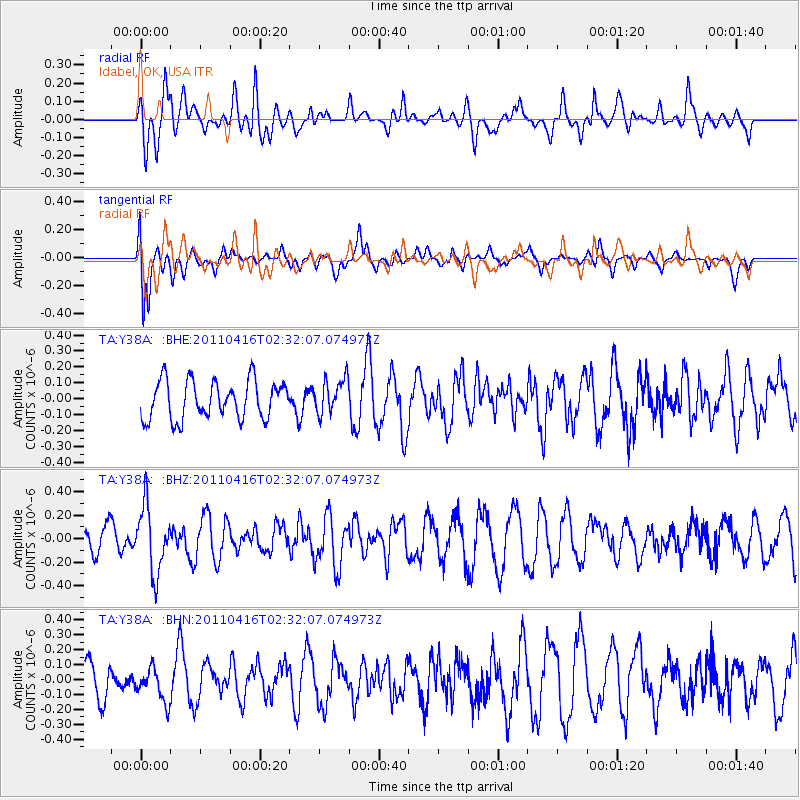
Y38A Idabel, OK, USA - Earthquake Result Viewer
*The percent match for this event was below the threshold and hence no stack was calculated.
| Earthquake location: |
Eastern Honshu, Japan |
| Earthquake latitude/longitude: |
36.4/139.7 |
| Earthquake time(UTC): |
2011/04/16 (106) 02:19:30 GMT |
| Earthquake Depth: |
77 km |
| Earthquake Magnitude: |
5.9 MB, 5.8 MW, 5.8 MW |
| Earthquake Catalog/Contributor: |
WHDF/NEIC |
|
| Network: |
TA USArray Transportable Network (new EarthScope stations) |
| Station: |
Y38A Idabel, OK, USA |
| Lat/Lon: |
33.93 N/94.73 W |
| Elevation: |
118 m |
|
| Distance: |
93.6 deg |
| Az: |
42.631 deg |
| Baz: |
318.902 deg |
| Ray Param: |
$rayparam |
*The percent match for this event was below the threshold and hence was not used in the summary stack. |
|
| Radial Match: |
51.122673 % |
| Radial Bump: |
393 |
| Transverse Match: |
64.22745 % |
| Transverse Bump: |
400 |
| SOD ConfigId: |
356183 |
| Insert Time: |
2011-09-30 05:19:00.158 +0000 |
| GWidth: |
2.5 |
| Max Bumps: |
400 |
| Tol: |
0.001 |
|
Signal To Noise
| Channel | StoN | STA | LTA |
| TA:Y38A: :BHZ:20110416T02:32:07.074973Z | 2.9473732 | 2.799996E-7 | 9.499971E-8 |
| TA:Y38A: :BHN:20110416T02:32:07.074973Z | 0.68866205 | 1.1280974E-7 | 1.6381E-7 |
| TA:Y38A: :BHE:20110416T02:32:07.074973Z | 0.915976 | 1.09802E-7 | 1.1987433E-7 |
| Arrivals |
| Ps | |
| PpPs | |
| PsPs/PpSs | |


