You are here: Home > Network List > AZ - ANZA Regional Network Stations List
> Station SMER AZ.SMER > Earthquake Result Viewer
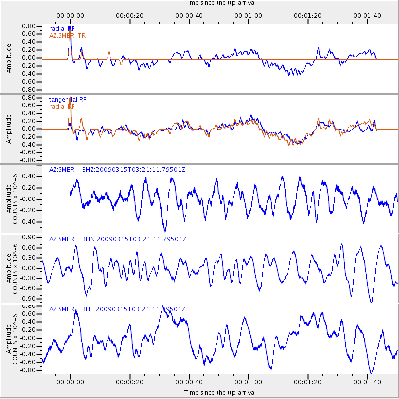
SMER AZ.SMER - Earthquake Result Viewer
*The percent match for this event was below the threshold and hence no stack was calculated.
| Earthquake location: |
Galapagos Islands Region |
| Earthquake latitude/longitude: |
2.4/-95.1 |
| Earthquake time(UTC): |
2009/03/15 (074) 03:14:31 GMT |
| Earthquake Depth: |
10 km |
| Earthquake Magnitude: |
5.5 MS, 5.4 MB, 5.8 MW, 5.8 MW |
| Earthquake Catalog/Contributor: |
WHDF/NEIC |
|
| Network: |
AZ ANZA Regional Network |
| Station: |
SMER AZ.SMER |
| Lat/Lon: |
33.46 N/117.17 W |
| Elevation: |
355 m |
|
| Distance: |
37.1 deg |
| Az: |
328.677 deg |
| Baz: |
141.588 deg |
| Ray Param: |
$rayparam |
*The percent match for this event was below the threshold and hence was not used in the summary stack. |
|
| Radial Match: |
51.685368 % |
| Radial Bump: |
400 |
| Transverse Match: |
55.05957 % |
| Transverse Bump: |
400 |
| SOD ConfigId: |
2658 |
| Insert Time: |
2010-02-26 20:49:25.632 +0000 |
| GWidth: |
2.5 |
| Max Bumps: |
400 |
| Tol: |
0.001 |
|
Signal To Noise
| Channel | StoN | STA | LTA |
| AZ:SMER: :BHN:20090315T03:21:11.79501Z | 1.5584778 | 3.3000697E-7 | 2.1174954E-7 |
| AZ:SMER: :BHE:20090315T03:21:11.79501Z | 0.6667686 | 3.3555173E-7 | 5.0325065E-7 |
| AZ:SMER: :BHZ:20090315T03:21:11.79501Z | 2.2440426 | 3.2254755E-7 | 1.4373504E-7 |
| Arrivals |
| Ps | |
| PpPs | |
| PsPs/PpSs | |


