You are here: Home > Network List > AZ - ANZA Regional Network Stations List
> Station SMER AZ.SMER > Earthquake Result Viewer
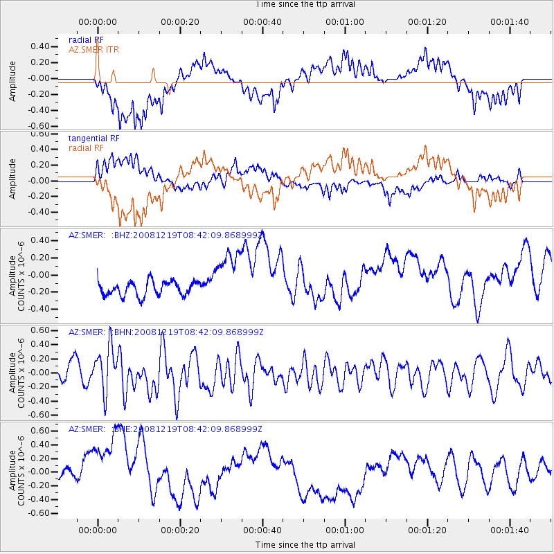
SMER AZ.SMER - Earthquake Result Viewer
*The percent match for this event was below the threshold and hence no stack was calculated.
| Earthquake location: |
Northern Mid-Atlantic Ridge |
| Earthquake latitude/longitude: |
47.0/-27.3 |
| Earthquake time(UTC): |
2008/12/19 (354) 08:31:51 GMT |
| Earthquake Depth: |
2.0 km |
| Earthquake Magnitude: |
5.8 MB, 5.6 MS, 5.9 MW, 5.8 MW |
| Earthquake Catalog/Contributor: |
WHDF/NEIC |
|
| Network: |
AZ ANZA Regional Network |
| Station: |
SMER AZ.SMER |
| Lat/Lon: |
33.46 N/117.17 W |
| Elevation: |
355 m |
|
| Distance: |
66.3 deg |
| Az: |
294.121 deg |
| Baz: |
48.35 deg |
| Ray Param: |
$rayparam |
*The percent match for this event was below the threshold and hence was not used in the summary stack. |
|
| Radial Match: |
61.238876 % |
| Radial Bump: |
400 |
| Transverse Match: |
57.213154 % |
| Transverse Bump: |
400 |
| SOD ConfigId: |
2658 |
| Insert Time: |
2010-02-26 20:49:30.862 +0000 |
| GWidth: |
2.5 |
| Max Bumps: |
400 |
| Tol: |
0.001 |
|
Signal To Noise
| Channel | StoN | STA | LTA |
| AZ:SMER: :BHN:20081219T08:42:09.868999Z | 1.6535965 | 3.2584725E-7 | 1.9705367E-7 |
| AZ:SMER: :BHE:20081219T08:42:09.868999Z | 3.528016 | 6.6292654E-7 | 1.879035E-7 |
| AZ:SMER: :BHZ:20081219T08:42:09.868999Z | 4.189984 | 3.5141298E-7 | 8.386977E-8 |
| Arrivals |
| Ps | |
| PpPs | |
| PsPs/PpSs | |


