You are here: Home > Network List > AZ - ANZA Regional Network Stations List
> Station SMER AZ.SMER > Earthquake Result Viewer
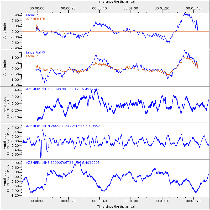
SMER AZ.SMER - Earthquake Result Viewer
*The percent match for this event was below the threshold and hence no stack was calculated.
| Earthquake location: |
Southeast Of Ryukyu Islands |
| Earthquake latitude/longitude: |
24.9/128.0 |
| Earthquake time(UTC): |
2009/07/06 (187) 22:35:05 GMT |
| Earthquake Depth: |
10 km |
| Earthquake Magnitude: |
6.1 MB, 5.3 MS, 5.7 MW, 5.7 MW |
| Earthquake Catalog/Contributor: |
WHDF/NEIC |
|
| Network: |
AZ ANZA Regional Network |
| Station: |
SMER AZ.SMER |
| Lat/Lon: |
33.46 N/117.17 W |
| Elevation: |
355 m |
|
| Distance: |
95.1 deg |
| Az: |
49.632 deg |
| Baz: |
304.125 deg |
| Ray Param: |
$rayparam |
*The percent match for this event was below the threshold and hence was not used in the summary stack. |
|
| Radial Match: |
35.48463 % |
| Radial Bump: |
400 |
| Transverse Match: |
34.26788 % |
| Transverse Bump: |
400 |
| SOD ConfigId: |
2648 |
| Insert Time: |
2010-02-26 20:49:34.574 +0000 |
| GWidth: |
2.5 |
| Max Bumps: |
400 |
| Tol: |
0.001 |
|
Signal To Noise
| Channel | StoN | STA | LTA |
| AZ:SMER: :BHN:20090706T22:47:56.493999Z | 3.2429986 | 3.2760897E-7 | 1.0102038E-7 |
| AZ:SMER: :BHE:20090706T22:47:56.493999Z | 2.0025232 | 7.582583E-7 | 3.7865144E-7 |
| AZ:SMER: :BHZ:20090706T22:47:56.493999Z | 2.1479883 | 3.312801E-7 | 1.5422806E-7 |
| Arrivals |
| Ps | |
| PpPs | |
| PsPs/PpSs | |


