You are here: Home > Network List > AZ - ANZA Regional Network Stations List
> Station SMER AZ.SMER > Earthquake Result Viewer
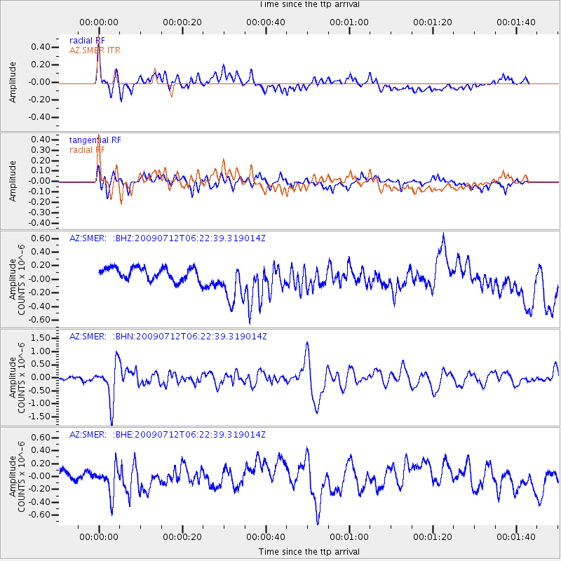
SMER AZ.SMER - Earthquake Result Viewer
*The percent match for this event was below the threshold and hence no stack was calculated.
| Earthquake location: |
Southern Peru |
| Earthquake latitude/longitude: |
-15.0/-70.4 |
| Earthquake time(UTC): |
2009/07/12 (193) 06:12:47 GMT |
| Earthquake Depth: |
199 km |
| Earthquake Magnitude: |
5.7 MB, 6.1 MW, 6.1 MW |
| Earthquake Catalog/Contributor: |
WHDF/NEIC |
|
| Network: |
AZ ANZA Regional Network |
| Station: |
SMER AZ.SMER |
| Lat/Lon: |
33.46 N/117.17 W |
| Elevation: |
355 m |
|
| Distance: |
65.7 deg |
| Az: |
318.083 deg |
| Baz: |
129.459 deg |
| Ray Param: |
$rayparam |
*The percent match for this event was below the threshold and hence was not used in the summary stack. |
|
| Radial Match: |
48.07847 % |
| Radial Bump: |
400 |
| Transverse Match: |
67.099495 % |
| Transverse Bump: |
400 |
| SOD ConfigId: |
2648 |
| Insert Time: |
2010-02-26 20:49:35.876 +0000 |
| GWidth: |
2.5 |
| Max Bumps: |
400 |
| Tol: |
0.001 |
|
Signal To Noise
| Channel | StoN | STA | LTA |
| AZ:SMER: :BHN:20090712T06:22:39.319014Z | 8.684235 | 7.324064E-7 | 8.433747E-8 |
| AZ:SMER: :BHE:20090712T06:22:39.319014Z | 1.9127927 | 2.090267E-7 | 1.0927828E-7 |
| AZ:SMER: :BHZ:20090712T06:22:39.319014Z | 3.4726012 | 3.218827E-7 | 9.2692105E-8 |
| Arrivals |
| Ps | |
| PpPs | |
| PsPs/PpSs | |


